Thursday, May 29, 2014

May Ends Magnificently!

Good Morning!

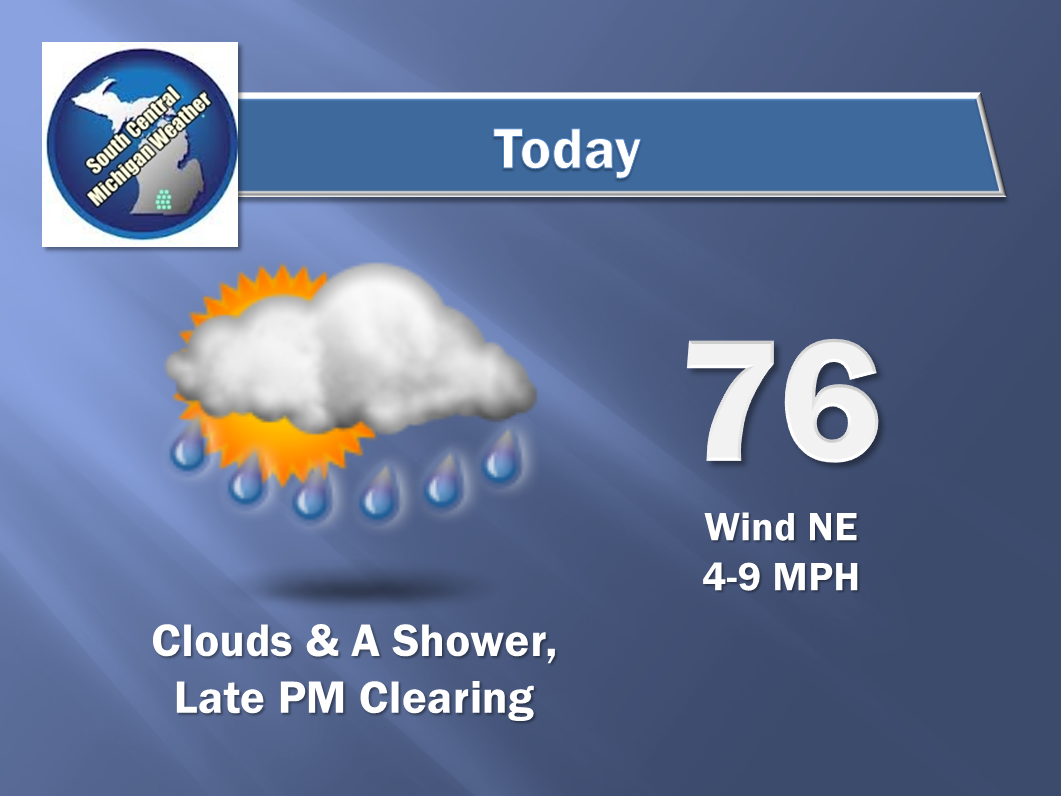
The cloudy skies have moved away, plenty of sunshine even if it's a touch cool to start the day today!

I need to confess a bust - We had showers in the area yesterday, but while computer models did OK forecasting the general coverage area, all we saw were sprinkles or a quick shower here and there, as opposed to the more widespread rain I called for.  I'd be curious to hear if anyone in the area got much more than sprinkles.  Jackson got a couple of quick raindrops and that's it.  Radar stayed decidedly spotty as well. Now, time to lift the hood and see what's running under there...

NO SEVERE HERE:  The US as a whole is pretty docile over the next 72 hours according to the Storm Prediction Center.  The only severe risk they outline is on Saturday, and that's a Slight risk for severe storms in the High Plains, impacting parts of Wyoming, Colorado, South Dakota and Nebraska.  No storm chances per SPC at all in the Great Lakes.

VERY QUIET STRETCH & A FINE WEEKEND AHEAD:  Upper-air ridging to the southwest, meaning very warm weather into the western Great Plains, Rockies, and the Desert Southwest, with some quasi-zonal upper flow working through the Great Lakes.  There's nothing but high pressure in the pipeline right now, so no weather issues to worry about.  A bit of northerly turn to the winds keeps things right around average or just a touch warmer temperature wise.  Keep the sun around but bump the temperature into the low 80's for the weekend.  Have a look at the national temperature map:


RAIN-FREE THROUGH SUNDAY:  Almost four days of rain-free weather on tap for you in South Central Michigan!  Model data doesn't even hint at rain until Sunday night.  We start clouding things up late Sunday afternoon, then introduce a chance of showers again at sunset or later.  It's a big green light for anything you'd want to do outdoors before then.  With all that being said, as we warm up again, could we pop a random shower or storm?  Absolutely - it's summer in the Great Lakes.  Do I see that happening? Nope.

NEXT FREE LAWN WATERING?:  As it stands now, Monday and Tuesday are the next chances at showers and thunderstorms in the area, they'll also be the warmest days of the next six.  If we look at modeling, current thinking is an upper disturbance works into Michigan on Monday, getting us wet, then that's followed by a bona fide surface low that starts in the Plains and sits in central Wisconsin on Tuesday. It's close enough to give us some unsettled weather right through midweek.  Have a peek at the 5 Day Precipitation Map from the Weather Prediction Center:

This is a pretty damp look for the area, with a 2" of rain target sitting on Grand Rapids.  If this solution holds, expect some minor flooding issues, especially in Ionia and Clinton counties!
Now, this map appears at first blush to not jibe with the forecast, but what you're seeing is the result of that upper wave in here on Monday, and the rain triggered by Mr. Real Deal Low from Tuesday on.

Here's the big picture:


Nothing but beautiful clear skies in the area; just a bit of cloud in northern Illinois and far south Wisconsin:


And here's the forecast:


The extended outlook shapes up like this:


That's it!  I hope you have a great Thursday!  Blessings.

Wednesday, May 28, 2014

Gray Hump Day - Terrific Thursday...

Good Morning!

What a difference a couple of days make!  Overcast conditions and even some fog in the area this morning as I write.  Some areas last night were visited by some showers and thunderstorms, a few of the storms did have the small hail, gusty wind, and heavy rain that I talked about.  Let's have a look and see what's running under the hood:

CLOUDS AND A BIT HUMID:  It will feel a bit sticky out today, with relative humidity values up around the 80-90% mark for awhile.  We'll see those values come down this evening, but to get that drier air, we have some spotty showers or a rogue thunderstorm to worry about until we get there.  Here's Tru-Track Doppler right now:


If you draw a straight line from Ludington to Port Huron, anything south of that line will have the best chances of showers today.

A CHANCE OF SHOWERS THROUGH THIS EVENING:   No big deal, nothing severe, just a bit of rain and such as the upper air patterns shift some.  The RAP and Hi-Res RAP forecast models are showing in their futurecasts that we increase the coverage of rain from isolated to scattered through the evening, then taper it off.  The best chance of rain is along and south of I-96.  Have a look at the latest 5 Day Rainfall forecast from the Weather Prediction Center:

Rain forecast map for the Lower 48 through 8 AM Monday June 2nd.  We're pretty dry here in Michigan, with a quarter-inch or less of rain forecast for the Lower Peninsula.  This map won't factor in pop-up showers and storms like we had yesterday and will have today, so your mileage will vary.
CLEARING AFTER THE RAINS:  After the rains depart, we expect clearing skies along with air that isn't really that much cooler, but it will feel like it, as dewpoint and humidity values come down from where they are right now.  It will feel good, I promise you, and that sets the stage for...

ANOTHER WEATHER WINNER:  Plenty of sunshine, seasonably warm readings, those themes continue, with the next chance of substantial rain coming next week.  All indications point to Monday for that rain.  Here's a look at current temperatures around the great US of A.

Surface Temperatures as of 9 AM EDT
Here's a sneak peek at the next few days in the area:


And here's the forecast for Jackson and vicinity:


I hope you have a wonderful day!  Blessings.

Tuesday, May 27, 2014

A Touch Of Rain - Then Back To The Good Stuff!!!

Good Morning -

We are nearing the end of the really spectacular weather we had the last several days.  I hope that you got to enjoy a restful Memorial Day holiday, as we kicked off summer in fine fashion.  Let's see what's changing here the next few days:

BLUE SKIES GET CLOUDY BRIEFLY:  The crisp blue skies that we enjoyed the last several days thanks to a high pressure center parked basically on top of us have given way to mixed and hazy sunshine as we head into this evening and tomorrow.  The high has moved on to the east some, allowing a disturbance or two to work into Michigan.  The bigger picture is a split flow pattern; fairly zonal across the northern half of the nation, and a definite ridge south and west.  Those two guys are parked over the majority of the lower 48 like a fat cat - and not moving a whole lot.  In time the ridge advances and expands into the Midwest and Great Lakes, but for now, there's enough wiggle room in the northern flow for small disturbances to sneak in, touching off some showers and a storm.  The good news is another lobe of high pressure is expected right behind today's little wave, so sunny skies will return, along with dry conditions!

HIT AND RUN RAIN:  I have said it many times before, but I will say it here again - computer forecast models stink at picking out the location and timing of summer convection in the absence of any real dynamic features (frontal boundary, dryline, upper wave, bona fide low), when you otherwise have enough moist air and heating to make the atmosphere floaty and unstable.  That being said, all the model data and maps I have reviewed thus far point to rain this afternoon and evening.  Therefore, the forecast includes periods of scattered to numerous showers and a couple of buried thunderstorms as we work into the back half of the day.  Neither I or the Storm Prediction Center see any severe weather in the offing - have a look at today's risk map:

SPC Day 1 Risk - Lower 2/3 of Michigan is "General T-Storms"
As you can see, all of the rough stuff is expected down in TX and LA.  Tomorrow and Thursday, Michigan gradually gets shaved out of the thunderstorm picture altogether!  Now...with the "SEE TEXT" area that SPC has placed over western IL into IA; I'm leaving open the possibility that we may see a strong storm this afternoon or tonight.  If that shows up, it could have gusty wind, and maybe some heavy rain.  Hail, if any, would only be green pea sized or smaller.  As I type this before lunchtime, there's a bit of fuss in WI and back over NE and IA on the radar, and the NE/IA one is the group I'm watching to see if it takes off and intensifies into an unruly mob of storms.

NO WORRIES ABOUT WARMTH:  I say that to tell you that we'll see mild summer conditions over the next several days, with the lion's share of the temperature readings topping out at 84 or below until next week.  Nighttime lows will actually be a bit on the cool side from Thursday through Saturday.  Forecast models are advertising lower 50's at night throughout South Central Michigan, assuming their solutions to future activity are valid.  All in all, a fine start to the summer in South Central Michigan!


Now that the detailed stuff is on the table - here's the forecast for Jackson and surrounding areas including Leoni Township and Concord:


And here's the extended outlook:


I hope you have a wonderful day!  Blessings.

Monday, May 26, 2014

I See Summer...

Good Afternoon!

I hope that you are enjoying this gorgeous Memorial Day 2014.  Plenty of sunshine and warm weather abound to unofficially kick off summer!

SUMMER-LIKE PATTERN FIRMLY IN PLACE:  You'll notice the typical warm season pattern in this part of the world taking hold.  Morning sunshine, increasing PM clouds, with some hit or miss showers and thunderstorms developing around evening drive and in some cases persisting until later at night when the air cools.

A FEW CHANGES ON THE WAY:  As the day winds down you'll see an increase in clouds.  There is a chance of some isolated or widely scattered showers or even a lonely thunderstorm in the area tonight with better chances tomorrow, pushing the rain threshold to more of a widely scattered to scattered motif during the day.  Temperatures remain around the 80 mark.

DRY AGAIN AFTER MIDWEEK:  After we get through Tuesday/Wednesday, things dry out again, and we don't see a real credible chance of rain again for almost a week, so you'll surely need to sprinkle to keep the lawn green.

NOTHING IN THE WAY OF SEVERE:  Right now the Storm Prediction Center has us with just the garden variety thunderstorm chances, and the sever risk bubbles are well removed from Michigan.  That being said - a pop up thunderstorm in the right conditions could go marginally severe, with small hail and gusty wind.  Be aware.

Here's the forecast for Jackson and surrounding areas:

Tonight - Increasing clouds, some areas could see a shower or even a small storm, low 61.

Tuesday - Mainly cloudy, some sun will peek through, scattered showers or a storm are possible in spots, high 83, winds W 4-7 MPH.

Tuesday Night - Continued cloudy, still the chance of a shower or storm, low 62.

Wednesday - A chance of some showers early, then clearing, mainly sunny by late afternoon, high 80.

Thursday - Sunny and mild, high 82.

Friday - Plenty of sunshine and gorgeous, high 82.

Saturday - Sunny & Pleasant, high 80.

I hope you have a great rest of your holiday!  Blessings.