Plenty of shower and thunderstorm activity in the area this morning, fortunately, not a big deal aside from the continuing rain causing some flooding issues over the next few days. Let's have a look at it all:
RAINY NOW: A look at the Grand Rapids NEXRAD radar loop for the last hour or so shows those showers and storms working into and through the area...
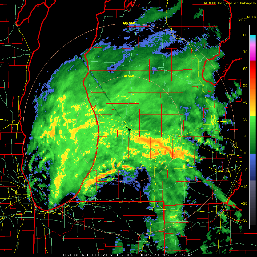
You can see the core of the low tracking north-northeast, with the dry slot working up toward Calhoun and Ingham counties. That will allow a bit of a breather, but wrap around precipitation on the back side will fill in soon thereafter. At least it's not cold enough that we have to worry about snow.
SEASONABLE TEMPERATURES: Average high in the are this time of year is right about 66 degrees, and except for a cool snap Monday and Tuesday, we'll be in the ballpark. Mid 60's, then a dip into the 50's for Tuesday and Wednesday and then we get back into the seasonal range.
WHAT ABOUT PRECIPITATION: Well, the showers and such are going to linger through Tuesday or perhaps even Wednesday before we get a real opportunity to dry out. The latter half of the week does look to be sunny and seasonable, so hang in there! Here's what the Weather Prediction Center is thinking regarding rain for the next five days:

You see that for most of the area we are looking at anywhere from three-quarters to 1 3/4 inches of rain. That will likely cause some flooding along riverbanks and in low-lying areas. The good news is that after that, no really organized chances of rain on the horizon.
I hope that you have a wonderful day!