Saturday, August 25, 2012

Summer-Like Weekend, Showers Start The Week...

Good Afternoon!

With a break at the straight job (hopefully for not too much longer the straight job), I am going to give you the abbreviated forecast discussion that I promised you earlier this morning when I released the forecast graphics for today and tonight.

TEMPERATURES:  We'll see temperatures around the area top out in the 90's in more than a few places today, with it feeling almost 95 in some places as dewpoints continue to climb slowly.  We stay in this regime through tomorrow,  and then as our next weather-maker comes in, we have a good chance at bringing some rains that drop us back into the 77-83 territory that we had last week.

RAIN:  Depending on which model you ask, we could see some showers and storms as early as tomorrow evening, or later on into Monday afternoon.  Here's what the National Weather Service has to say about our rain chances for the next five days in the area:
5 Day Precipitation Forecast
For my money, I honestly think that the computer modeling has it right on both counts, if only in part.  We can't rule out a scattered shower or storm on Sunday afternoon into the evening hours, but I think the best chances of rain come on Monday.

SEVERE WEATHER:  There's not much of that to be had in this part of the world for the next three days.  In fact, all we have here is a general risk of regular thunderstorms in the area through Monday, and any that do occur are not expected to be severe at this point.  All of the rough stuff looks to be on the Gulf Coast and Florida Panhandle as Isaac makes landfall early next week.  Again, no direct impact from Isaac is expected to occur here in Michigan.

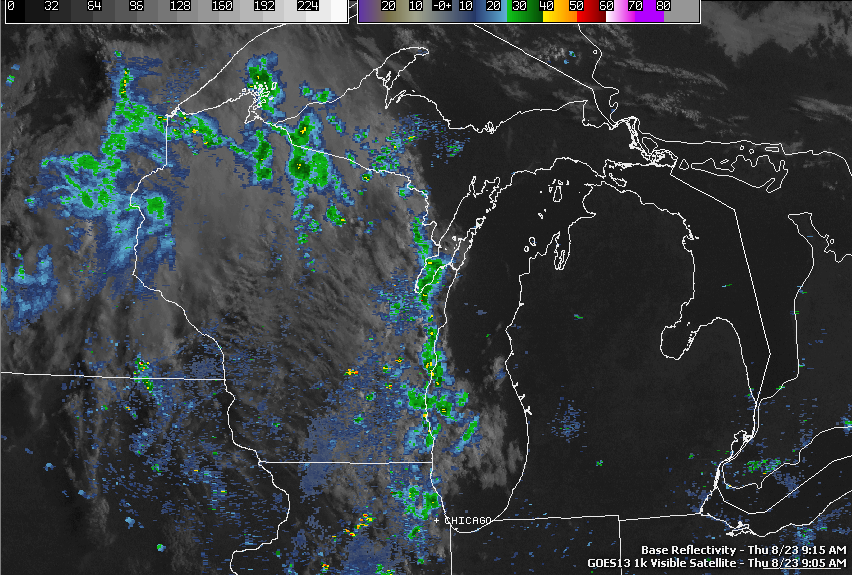
Mainly clear skies with just a bit of puffy cumulus from the afternoon heating starting to dot the visible satellite over Michigan...
Visible Satellite Image
There's nothing on the Grand Rapids NEXRAD, so here's your forecast for Jackson County: 

For the rest of Saturday, mostly sunny, very warm, becoming more humid, high 90.  Southerly winds 5-10 MPH.

Tonight, mainly clear skies, perhaps a few passing clouds late, low of 62, winds keep at the southerly 5-10 MPH speeds.

Sunday, continued mostly sunny and very warm, clouds will start moving in late in the day, high 89, winds SSW 7-13 MPH.

Sunday night, becoming cloudy, a chance of scattered showers and thunderstorms toward daybreak Monday, low 65, winds turning W 6-11 MPH.

Monday, mostly cloudy, scattered showers and thunderstorms during the day, these start to break up into the evening, high 82.

Tuesday, a mix of clouds and sunshine, cooler, chance of a stray lingering shower, high 78.

Wednesday, continued partly sunny, high 81.

Thursday, mostly sunny, pleasant, high 82.

Friday, sunny to start, clouds increase as the day progresses, chance of a scattered shower or storm by evening, high 82.

There's a look at your six day forecast, I do hope that you have a great Saturday!  Blessings.

A Quick Note About Isaac...

Hey Everyone...

Just so people don't think I am ignoring the developing weather story that is Tropical Storm Isaac...he has passed Haiti and is headed for the open waters of the Gulf Of Mexico with maximum sustained winds of 60 MPH.  He is forecast to make landfall along the Florida Panhandle, with a slight chance to possibly brush Alabama's Gulf coast.  I am not seeing any of his remnant storms impacting us.  The latest GFS computer model run has his remnants migrating as far north as Kentucky and far southern Indiana before a trough snaps up the low pressure center and pushes that stuff east.  So again, no direct impact here in Michigan from Isaac's leftovers is expected.

Quick Look For Saturday!!!

Good Morning!

We'll have time for a detailed discussion and forecast later, but here's how Saturday looks in South Central Michigan!  Hard to believe that in less than two weeks the summer season ends with Labor Day!


The complete discussion and six day forecast are on the way!!!

Friday, August 24, 2012

Quick Look At Friday!!!

Good Afternoon!

No time for a detailed discussion today, but here's the forecast for the rest of your Friday...


I plan to put together a discussion for the weekend tonight or tomorrow.  Have a great rest of your Friday!

Thursday, August 23, 2012

Sun, Warmth, Summer...The Sequel...

Good Morning!

We have another beautiful day in store for South Central Michigan, plenty o' sun and warm temperatures.  Let's take a deeper dive and see what's going on...scuba tank ready?  Here we go:

TEMPERATURES:  We are approaching the peak of the warming that we find ourselves in the middle of today.  Temperatures should get into the low to mid 80's across the area, and in fact, most of Michigan south of I-96 should see temperatures in the 79-85 range.  We'll keep that trend going right through Saturday, with night readings falling into the 50's, but we'll see those creep up as well, rolling back into only the low 60's on Saturday night, according to short-range modeling.  Dewpoints will start to creep up a bit as well.  After that, we get some showers and a maybe a thunderstorm into the area, that cools us back into a mid to upper 70's look for early next week.

RAIN:  The National Weather Service has changed the forecast a bit again for rain the next five days.  Computer modeling is still saying that a disturbance and what looks like a bona fide surface low originates in Missouri, but then the models march it more due north than yesterday, and it looks like they also slow it down too.  Here's that map for you:

5 Day Precipitation Forecast Map
That look will mess with the weekend rain forecast for another day or so.  For my money, I think we still get some beneficial rain, but the timing changes to later on into Monday, instead of a late Sunday into Monday affair.  Forecasting rain during the warm season in the absence of a good frontal boundary is a colossal pain in the rear!  About all you can truly say with certainty as a forecaster in that situation, is that a given area has an x out of 10 chance to see rain.  Beyond that, roll the dice.  Really.  The science is slowly evolving so we can refine our forecasting, but it takes time. Anyhow, that's my take on rain.  Moving on...

SEVERE WEATHER:  Not in this part of the world.  In fact, everything looks fairly calm for severe weather in the United States for the next three days, unless you count Isaac approaching the mainland, and even that doesn't happen until next week.  Nothing but general plain vanilla thunderstorm activity in Michigan for the next three days according to the Storm Prediction Center.

Grand Rapids NEXRAD shows a broken line of weak showers out over Lake Michigan and back into Wisconsin and the Chicago metro.  My thinking is those should fall apart between there and South Central Michigan, but the lakeshore may get a little bit of quick shower activity. There's an upper disturbance that bothering the atmosphere just enough to cloud it up some and spark those showers.  Here's the visible satellite with the regional radar mosaic overlaid on it so you can see the upper disturbance...

Visible Satellite Image and Regional NEXRAD Composite OverlaY
Here's the forecast for Jackson...


Today, sunny and warm, high 84, winds SW 3-7 MPH.

Tonight, moonlit and pleasant with possibly a stray cloud, warmer, nighttime low 58, winds SW 3-6 MPH.

Friday, partly to mostly sunny and warmer, high 85, winds SSW 5-9 MPH.

Friday night, a mix of clouds and stars, comfortable, low 58.  Winds SW 3-7 MPH.

Saturday, clear skies, warm and summery, high 86.

Sunday, starts clear, then clouds increase, we introduce a chance of a few widely scattered afternoon showers or a roaming thunderstorm, high 81.

Monday, mostly cloudy skies, some scattered showers and a couple of thunderstorms are possible, high 80.

Tuesday, a mix of clouds and sunshine, a touch cooler, high 79.

Wednesday, sunny skies, continued mild, high 78.

There's a look at your forecast for the next six days, I do hope that you have a good Thursday!  Blessings.

Quick Look - Thursday

Good Morning!

Discussion and six day outlook on the way, but here's my forecast for today...


We'll have the full scoop a little later!

Wednesday, August 22, 2012

Dry Into The Weekend, Summer Returns.....

Good Morning!

The title pretty much sums it up for you, we have warmer temperatures coming, well into the 80's in fact, by Saturday, and rain chances are still looking slim for the next few days.  Let's pop the hood and have a look...

TEMPERATURES:  Temperatures continues to warm back into summer levels, with daytime highs into the low to mid 80's and nighttime lows only rolling back to the 60's by the weekend.  Dewpoints also start to climb some, making it feel a bit more humid.  I don't expect to see any oppressive heat or humidity the next several days, but there will be no mistaking that summer is back.  If you want to go for a dip to cool down over the weekend, expect the water to be not as warm as in June and July with the unseasonably cool nights we have had the last week or so.  The flattening of the western upper air ridge continues through the weekend according to computer modeling, then another ridge/trough setup is on the table for next week, that should cool us down again somewhat.

RAIN:  The National Weather Service has shuffled the deck for the next five days regarding rain.  Yesterday was dry, today, the forecast calling for a quarter-inch to half-inch of rain in most of the blog area, that looks to come in later on Sunday sometime, if this is right.  Here's the map for you...
5 Day Precipitation Forecast
A disturbance is forecast to start in central Missouri late Saturday night and track up into Michigan by late Sunday night, aided by a low-level jet streak pushing it along.  That's when we'll see our best shot at showers and perhaps a thunderstorm or two.

SEVERE WEATHER:  The Storm Prediction Center still has a fairly quiet forecast in place for us for the next three days, with just general storm activity in the northern half of Michigan tomorrow and that's about it.

The developing severe weather story away from Michigan is Tropical Storm Isaac.  Depending on which forecast model I look at he could hit the Gulf Coast around the Florida Panhandle, other models have him turning right and becoming a potential issue for the Atlantic Coast.  Either way, I'll be watching.  Direct impact to Michigan would be non-existent or minimal at best, maybe showers and storms migrating up from the Gulf in conjunction with a low pressure system, if he in fact does make landfall there on the Gulf Coast.

Grand Rapids NEXRAD is quiet and not a cloud to be found in South Central Michigan.
  
Visible Satellite Image
Here's the forecast for Jackson and surrounding communities including Grass Lake and Liberty Township...

Today, sunny and seasonably warm, high 82, winds SW calm to 5 MPH.

Tonight, clear and moonlit, not quite as cool as past nights, lows roll back to 51, winds SW calm to 4 MPH.

Thursday, continued sunny and warm, high 83, winds S 4-9 MPH.

Thursday night, more moonlight and maybe a scattered cloud, warmer, nighttime lows roll back to 58, winds SW 3-6 MPH.

Friday, periods of clouds and sunshine, warmer, high 85.

Saturday, sunny, warm, high 86.

Sunday, sunny to start, clouds increase during the day, a chance of a few widely scattered showers or a roaming thunderstorm, high 82.

Monday, mostly cloudy skies, scattered showers and a couple of thunderstorms are possible, high 81.

Tuesday, partly cloudy and cooler, high 79.

There's a look at your forecast for the next six days, I do hope that you have a great hump day Wednesday!  Blessings.

Quick Look For Hump Day...

Another winner on tap for today, here's my forecast for you...


Discussion and extended outlook are on the way!

Tuesday, August 21, 2012

Lots of Sun, Warming Trend In Progress...

Good Afternoon!

Lots of sunshine with clouds that are thinning out over the area at this hour, and that trend continues.  Examining the satellite out over Lake Michigan and into Wisconsin, there's no clouds there, just blue skies.

Visible Satellite Image
Let's pop the hood and see what we have going on!

TEMPERATURES:  Temperatures are starting to creep up.  We saw temperatures in the 40's and low 50's the last few nights, that will change as we move ahead in the week.  Daytime highs are on the upswing as well, with temperature readings climbing into the lower to middle 80's by Friday, as damping of the upper-air ridge/trough pattern continues, and the resulting west-southwest flow allows all that heat that has been trapped in the southwest to spread eastward across the US.  I do not expect us to get roasted anymore like we did earlier on this summer, but we will see some readings that are definitely conducive to getting some sun and maybe cooling off in a pool or lake near you!  Nighttime readings will leave the 40's behind for awhile, and should warm into the 60's in time for the weekend.

RAIN:  Not a whole lot of that to talk about in this forecast, even though a semi-broken line of  showers and thunderstorms formed and dropped some heavy rain on the Detroit metro area.  Southern Macomb County is under an urban/small stream flood advisory through rush hour.  You can see those storms headed off into Canada and points east on the Detroit NEXRAD...

Detroit NEXRAD Radar
As it stands now, the next credible shot we have at rain this area is this weekend at the earliest, but it looks to be more late weekend, Sunday night into Monday.  We just don't bring a lot of moisture into the area before Friday, and to get rain, you typically have to have a sharp temperature gradient and some moisture, preferably from the Gulf of Mexico.  Neither of those conditions are in the forecast for the next few days, just a gradual warming.  That being said, computer modeling does indicate that dewpoints will start to creep up as the weekend approaches.  Here's a look at the forecast from the National Weather Service for the next five days...
5 Day Precipitation Forecast
The forecast map paints the picture...BONE DRY through the week and into the weekend.

SEVERE WEATHER:  We're getting into the time of year where the severe threat tends to stay fairly low for a few days at a time.  Typically, we find a "slight" risk on the map somewhere at least every two to three days, and they are in the Midwest, Great Plains, Dixie Alley, or Tornado Alley.  Not so now.  That will change as the seasons begin to morph from summer to fall, and we get unsettled weather again, as summer conditions fight to hang on in the face of the cold season arriving.  The whole US is in a pretty quiet pattern, with no formal severe risk areas outlined by the Storm Prediction Center for the next three days, and just a few "see text" areas on their maps that mark low end 5% chances for wind and hail issues.  That being said, all we need is a major pattern shift or a tropical system to make landfall someplace on the mainland, and then this regime goes out the window.

Sunshine and breezy here in the South Central Michigan Weather Zone at this hour, let's take a look at the forecast for you...

Tonight, mostly starry skies, with a few passing clouds nighttime low 50, winds die off and become calm, then SW to 5 MPH as daybreak approaches.

Wednesday, mostly sunny skies, warmer, high 79, winds SW calm to 5 MPH.

Wednesday night, skies remain mostly clear, maybe a couple of passing clouds, not quite as cool with lows rolling back to 53, winds SW 3-7 MPH.

Thursday, sunshine, some passing clouds later in the day, warmer, high 81, winds SW 4-9 MPH.

Thursday night, a mix of clouds and stars, low 55, winds S 3-7 MPH.

Friday, more sun than clouds, breezy and warmer, high 84, winds S 5-10 MPH.

Saturday, a mix of clouds and sunshine, a chance of a couple of scattered showers, perhaps a lonely thunderstorm, high 85.

Sunday, continued partly cloudy and warm, we still can't rule out a stray shower or storm, high 84.

Monday, partly sunny, not as warm, a chance at a widely scattered shower, high 80.

There's a look at your forecast for the next six days, I do hope that you have a great evening!  Blessings.

Monday, August 20, 2012

Quietly Warming...

Good Morning!

I must apologize in advance for the full forecast never getting posted yesterday (long story, don't ask).  Some things needed to be addressed at home, and I had to focus on that.  At any rate, we had a beautiful weekend with mostly sunny days and temperatures in the middle 70's.  We will keep that trend going, then start to warm it up some, and add just a few more clouds to the mix.  Let's pop the hood...

TEMPERATURES:  Mild late-summer days continue here in Michigan, with a high amplitude ridge/trough setup over the US right now.  Strong southerly flow and heat under the ridge in the Rockies and the Sun Belt, cool, dry air coming in from Canada under the trough that has the Midwest firmly in it's grasp for now.  Daytime 70's and nighttime 50's for the next few days, but as we get closer to the weekend, the upper-air pattern changes and everything dampens out into a nearly straight west to east flow.  When that happens, more summer-like readings return, with daytime highs back into the low to mid 80's.

RAIN:  Things look fairly dry here in south central Michigan for the next five days.  That being said, I do have to place a low chance of rain in the forecast for today.  Any rain that does fall will be hit or miss, with plenty of space between showers.  Here's what the National Weather Service is thinking regarding rain for the next five days...
5 Day Precipitation Forecast
Most areas pick up little, if any rainfall through Friday, and that looks reasonable based on the data for the next several days.

SEVERE WEATHER:  According to the Storm Prediction Center, you won't see any up here in Michigan, just a risk of plain Jane thunderstorms today for the south zone of the blog.  For my money, we'll see just spotty showers, but if any storms do get going, they will form, rain on you,  make just a little noise and not have much lightning, then go away.

Radar is quiet, and the infrared satellite is clear...

Infrared Satellite Image
I nearly forgot to mention that with the still air last night, some patchy fog is out there, and it can be dense in some areas, so use caution.

Here's the forecast for Jackson County...

Today, mainly sunny skies with a few clouds, an isolated shower or stray storm can't be ruled out, high 76, winds NW 3-7 MPH.

Tonight, starry skies, fog possible late, perhaps just a passing cloud, low 46, wind N calm to 4 MPH.

Tuesday, mostly sunny, warmer, high 78, winds turn SW 2-5 MPH.

Tuesday night, a couple of clouds, not quite as cool, low 51, wind SW calm to 5 MPH.

Wednesday, more sunshine than clouds, pleasant, high 78.

Thursday, continued partly to mostly sunny, high 80.

Friday, mainly clear, perhaps a few clouds, warmer, high 82.

Saturday, a mix of clouds and sunshine, perhaps the chance of an isolated shower or thunderstorm, high 83.

There's a look at your forecast for the next six days, I do hope that you have a great Monday!  Blessings.

DENSE FOG ADVISORY - SHIAWASSEE

The National Weather Service in Detroit has issued a Dense Fog Advisory until 9AM.  Still air last night allowed fog to form, and it can be dense, especially in low-lying areas.  Use caution until the sun comes up and warms the air to burn it off!

Sunday, August 19, 2012

Quick Look - Sunday!

Good Morning!

Forecast discussion on the way, here's the RACECast for the Pure Michigan 400 at Michigan International Speedway, and the outlook for today in Jackson...


Complete forecast on the way!