We have another beautiful day in store for South Central Michigan, plenty o' sun and warm temperatures. Let's take a deeper dive and see what's going on...scuba tank ready? Here we go:
TEMPERATURES: We are approaching the peak of the warming that we find ourselves in the middle of today. Temperatures should get into the low to mid 80's across the area, and in fact, most of Michigan south of I-96 should see temperatures in the 79-85 range. We'll keep that trend going right through Saturday, with night readings falling into the 50's, but we'll see those creep up as well, rolling back into only the low 60's on Saturday night, according to short-range modeling. Dewpoints will start to creep up a bit as well. After that, we get some showers and a maybe a thunderstorm into the area, that cools us back into a mid to upper 70's look for early next week.
RAIN: The National Weather Service has changed the forecast a bit again for rain the next five days. Computer modeling is still saying that a disturbance and what looks like a bona fide surface low originates in Missouri, but then the models march it more due north than yesterday, and it looks like they also slow it down too. Here's that map for you:
 |
| 5 Day Precipitation Forecast Map |
SEVERE WEATHER: Not in this part of the world. In fact, everything looks fairly calm for severe weather in the United States for the next three days, unless you count Isaac approaching the mainland, and even that doesn't happen until next week. Nothing but general plain vanilla thunderstorm activity in Michigan for the next three days according to the Storm Prediction Center.
Grand Rapids NEXRAD shows a broken line of weak showers out over Lake Michigan and back into Wisconsin and the Chicago metro. My thinking is those should fall apart between there and South Central Michigan, but the lakeshore may get a little bit of quick shower activity. There's an upper disturbance that bothering the atmosphere just enough to cloud it up some and spark those showers. Here's the visible satellite with the regional radar mosaic overlaid on it so you can see the upper disturbance...
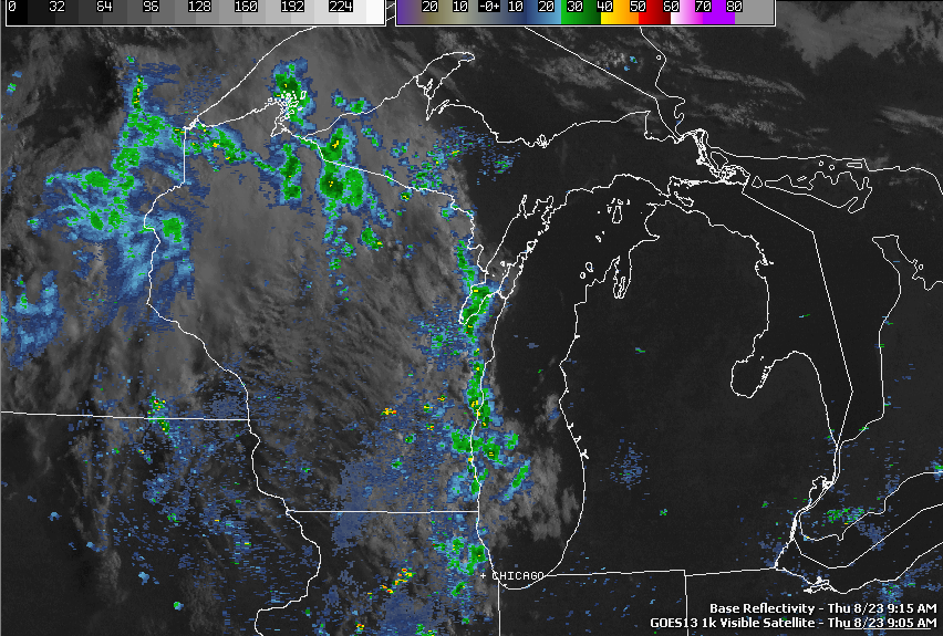 |
| Visible Satellite Image and Regional NEXRAD Composite OverlaY |
Today, sunny and warm, high 84, winds SW 3-7 MPH.
Tonight, moonlit and pleasant with possibly a stray cloud, warmer, nighttime low 58, winds SW 3-6 MPH.
Friday, partly to mostly sunny and warmer, high 85, winds SSW 5-9 MPH.
Friday night, a mix of clouds and stars, comfortable, low 58. Winds SW 3-7 MPH.
Saturday, clear skies, warm and summery, high 86.
Sunday, starts clear, then clouds increase, we introduce a chance of a few widely scattered afternoon showers or a roaming thunderstorm, high 81.
Monday, mostly cloudy skies, some scattered showers and a couple of thunderstorms are possible, high 80.
Tuesday, a mix of clouds and sunshine, a touch cooler, high 79.
Wednesday, sunny skies, continued mild, high 78.
There's a look at your forecast for the next six days, I do hope that you have a good Thursday! Blessings.
No comments:
Post a Comment