Saturday, May 24, 2014

More May Magic...

Good Morning!

A simply spectacular Memorial Day Weekend is on tap for us here in South Central Michigan.  I could say that's the forecast and wrap up and be on the money.  It's THAT nice.  Let's give some insight into what's going on right now...

HIGH PRESSURE DOMINATES:  We have a high pressure center sitting right over the top of us, and it's not really going to do a whole lot of moving between now and Memorial Day.  It's keeping us dry, with just some clouds in the mid early afternoon and then again as we get toward sunset.  Aside from that, make sure you have the sunscreen and bug spray with you.  All of the rain we had is responsible for a bumper crop of mosquitoes.

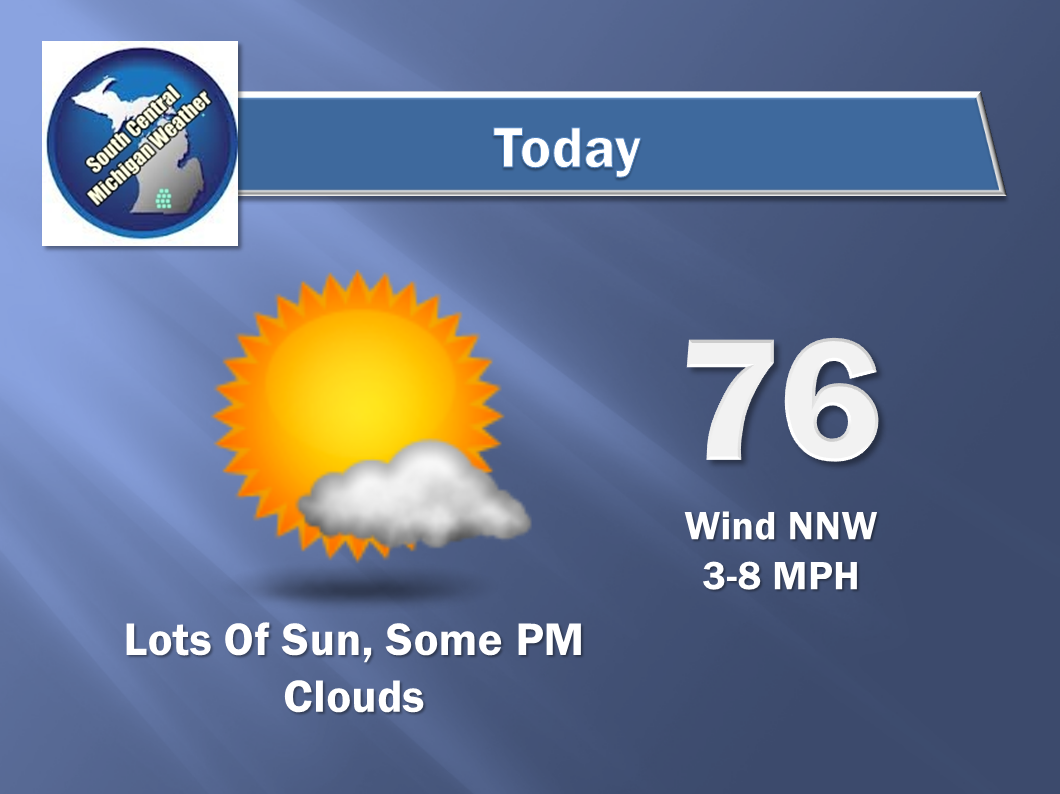
SEASONABLY WARM:  Average temperatures are right around 76 in this part of the world this time of year, and we'll match and exceed that over the next couple of days - but not by too much.  It won't be so hot that you can't enjoy the outdoors.  Everything looks to be running about as expected for the unofficial start of summer.  Meteorological summer, if you're curious, starts June 1st, and calendar summer, which is tied to the Summer Solstice, starts June 21st.

NO RAIN HERE:  All of this sunshine and great weather means that to keep the lawns nice and green you'll want to consider sprinkling a bit.  Here's a look at the precipitation map from the Weather PRedcition Center.  As you can see, not much action expected for the next five days, with a half-inch of rain as the high-water mark for a good chunk of lower Michigan...


The next real threat of rain appears to be Tuesday afternoon, which makes sense to me, considering that by then, we'll be up into 80+ territory on the thermometer, with increasing humidity values and such as well.

Now for the forecast for Jackson and surrounding areas including Spring Arbor and Rives Junction:


And here's the extended forecast - notice the cool down toward the end of the week after the midweek rain and storms...


I hope you have a great Saturday - Enjoy it!  Blessings.

Thursday, May 22, 2014

Walking On Sunshine...

Good Morning!

After a couple of days of showers and stormy weather in places including South Central Michigan, I Can sum up the next several in one word...SUNNY!  Let's have a look at what's going on, then I'll give you my forecast for the area.


HIGH PRESSURE IS PARKED HERE:  Not much to say beyond that really.  Now that the low pressure and and upper waves have moved on out of here, we have high pressure firmly locked into place, with plenty of sunshine and gentle breezes as part of the deal!

FANTASTIC WEEKEND!:  Temperatures in the mid to upper 70's and enough sunshine for anything you may want to do outdoors.  You couldn't ask for a better stretch of days.

RAIN-FREE FOR AWHILE:  I don't even really see the chances of a pop-up afternoon shower or storm that you typically see this time of year on the horizon.  This stretch of weather will help alleviate the flooding issues in Clinton and Shiawassee counties too.  The next credible chance at any rain looks to be Monday evening into Tuesday, and even that's only a 3 in 10 shot according to the forecast models.

There's nothing to see on the radars or satellite images, so let's just go right to the forecast:


And here's a look at a big win of a six day planner:


Forecasts like this make me think this is what it's be like in southern California if I were a forecaster.  Enjoy it!  Have a great Thursday!  Blessings.

Tuesday, May 20, 2014

SEVERE THUNDERSTORM WARNING - CALHOUN, EATON

THE NATIONAL WEATHER SERVICE IN GRAND RAPIDS HAS ISSUED A  
  
* SEVERE THUNDERSTORM WARNING FOR...  
  SOUTHEASTERN BARRY COUNTY IN SOUTHWEST MICHIGAN...  
  NORTHERN CALHOUN COUNTY IN SOUTH CENTRAL MICHIGAN...  
  SOUTHERN EATON COUNTY IN SOUTH CENTRAL MICHIGAN...  
  
* UNTIL 1230 AM EDT  
  
* AT 1138 PM EDT...A SEVERE THUNDERSTORM WAS LOCATED NEAR BANFIELD...  
  AND MOVING EAST AT 35 MPH.  
  
  HAZARD...60 MPH WIND GUSTS AND QUARTER SIZE HAIL.  
  
  SOURCE...RADAR INDICATED.  
  
  IMPACT...HAIL DAMAGE TO VEHICLES IS EXPECTED. EXPECT WIND DAMAGE TO  
           ROOFS...SIDING AND TREES.  
  
* LOCATIONS IMPACTED INCLUDE...   CHARLOTTE... BELLEVUE... KALAMO...   BROOKFIELD... OLIVET... CONVIS TWP...   LEE TWP... BEDFORD... ASSYRIA...   BANFIELD... LACEY... DOWLING...   CARLISLE... BURLEIGH CORNERS... PARTELLO...   ST MARYS LAKE... LEVEL PARK... PENNFIELD...     PRECAUTIONARY/PREPAREDNESS ACTIONS...     FOR YOUR PROTECTION MOVE TO AN INTERIOR ROOM ON THE LOWEST FLOOR OF A BUILDING.  

SEVERE THUNDERSTORM WATCH BRANCH, HILLSDALE, CALHOUN, JACKSON

THE NWS STORM PREDICTION CENTER HAS ISSUED A

* SEVERE THUNDERSTORM WATCH FOR PORTIONS OF
  NORTHERN INDIANA
  SOUTHERN LOWER MICHIGAN
  NORTHWESTERN OHIO
  LAKE MICHIGAN

* EFFECTIVE THIS TUESDAY NIGHT AND WEDNESDAY MORNING FROM 945 PM
  UNTIL 500 AM EDT.

* PRIMARY THREATS INCLUDE...
  SCATTERED DAMAGING WINDS AND ISOLATED SIGNIFICANT GUSTS TO 75
    MPH POSSIBLE
  ISOLATED VERY LARGE HAIL EVENTS TO 2.5 INCHES IN DIAMETER
    POSSIBLE

THE SEVERE THUNDERSTORM WATCH AREA IS APPROXIMATELY ALONG AND 60
STATUTE MILES EITHER SIDE OF A LINE FROM 20 MILES WEST OF SOUTH
BEND INDIANA TO 60 MILES EAST NORTHEAST OF FORT WAYNE INDIANA.
FOR A COMPLETE DEPICTION OF THE WATCH SEE THE ASSOCIATED WATCH
OUTLINE UPDATE (WOUS64 KWNS WOU3).

PRECAUTIONARY/PREPAREDNESS ACTIONS...

REMEMBER...A SEVERE THUNDERSTORM WATCH MEANS CONDITIONS ARE
FAVORABLE FOR SEVERE THUNDERSTORMS IN AND CLOSE TO THE WATCH
AREA. PERSONS IN THESE AREAS SHOULD BE ON THE LOOKOUT FOR
THREATENING WEATHER CONDITIONS AND LISTEN FOR LATER STATEMENTS
AND POSSIBLE WARNINGS. SEVERE THUNDERSTORMS CAN AND OCCASIONALLY
DO PRODUCE TORNADOES.

This Looks More Like Spring!

Good Morning!

Clouds and raindrops in the area, and a crack at some severe weather.  Let's have a look and see what's under the hood:

SEVERE WEATHER POSSIBLE LATER:  The Storm Prediction Center has us under the standard slight risk for some sever weather later on this afternoon.  They indicate that some supercell thunderstorms are possible initially, but then we should see a fairly organized line of storms.  Have a look at this graphic:


Pretty much the whole blog excepting places like Ovid, Elsie and Owosso are in the risk.

RAINY RIGHT NOW UP NORTH:  If you look at the radar pretty quiet here, but plenty of showers and storms to be had as you get north of Mt. Pleasant...


The rain up there dissipates and then our turn comes later on.  After that, clearing skies and seasonably nice weather.

SEASONABLE DAYS, COOL NIGHTS:  The good news, we finally get to where we should be weather wise this time of year, and we hold that pattern for the next week.  Today and tonight is the best organized chances of rain that I see, and as far as temperatures, we don't dip below 68 for daytime highs according to the forecast data I'm looking at right now.  Here's a look at readings across the nation right now:


This map is the temperature plot for the US as of about 8:45 AM EDT.  You see where the yellowish shading indicates the warmer air.  There's some moisture in that air being blown up here from the Gulf, and that's where you'll see the showers and storms fire at later today.

Looking ahead, we clear the skies tomorrow afternoon, keep that trend going, and see plenty of sunshine for the weekend with readings in 74-83 range.  Great stuff!

Here's the forecast:

Today - Cloudy, breezy, scattered to numerous afternoon showers and thunderstorms, some could be severe, high 74.  Wind SSE 8-15 MPH.

Tonight - More of today, some lingering showers or a thunderstorm, mild, lows roll back to 61. Winds SE 7-14 MPH.

Hump Day - Cloudy skies to begin, slow late day clearing.  Still the chance of a few scattered showers or a buried thunderstorm.  Warmer, high 80.  Wind SW 6-12 MPH.

That's a look at the next couple of days for you.  I will work on the six day planner as time permits today.  Have a great one!  Blessings.

Monday, May 19, 2014

Quick Peek at Early Week...

Good Morning!

After being away this weekend as a soccer referee, we're back in front of the laptop with a look at the weather for you.  I tell you what, quiet and seasonable look like the two big words for us for the next few days, with just some scattered showers or storms in the afternoons.  Typical warm season pattern for you.  Let's have a look:

DAMP BUT DECEIVING:  Here's a look at the Weather Prediction Center 5 Day precipitation map:


An inch of rain throughout most of the state for the next five days, and according to forecast data, that comes in the guise of scattered showers and thunderstorms, especially in the afternoon.  That being said, I do see the chance at some showers and such tonight and into early tomorrow morning.  The next chance after that, tomorrow afternoon and evening under some cloudy skies.  Beyond that, pretty quiet for the rest of the week with just the pop-up storm chances.

Here's the forecast:

Today - mainly sunny, clouds increase in the afternoon, high 72.  Wind SW 4-8 MPH.

Tonight - becoming cloudy, some scattered showers or a thunderstorm late, low 50, wind SW 5-10 MPH.

Tuesday - mixed sunshine, some pop-up showers or a thunderstorm or two in the afternoon, high 75.  Wind S 6-12 MPH.

Wednesday - more clouds, still the chance of an isolated shower or storm, high 74.

There's an abbreviated look at the forecast, I hope you have a wonderful day!