Saturday, August 2, 2014

Not A Lot Of Changes...

Good Morning!

More mixed sunshine in the area as the pattern that we have been in for the last several days persists.  Let's take a closer look:

UPPER AIR STANDING PAT:  Taking a look at the upper air maps this morning, the ridge west trough east setup is still there and not going to move much.  We'll continue to have a few disturbances working through the big picture, but the main focus will be the popcorn thunderstorms that occur during the afternoon and evening as daytime heating of the ground creates localized pockets of instability.  If you look at the current surface temperature map, you can use the 65 degree line as a general guideline to see what I mean...


Still no massive heat waves in the offing.  We have been fortunate this summer with the amount of cool weather we have experienced, and I still am not seeing any major heating in the cards.  Temperatures in this part of the world average right around 82, and we'll stay in that range.  An 85 or two is possible with some sunshine tomorrow and perhaps into early next week, but that's about it!

NO WIDESPREAD SEVERE WEATHER THREAT:  With that being said, don't be shocked if you see me post for a severe thunderstorm warning somewhere in the blog.  The last few days have been conducive to strong or even severe storms on a localized scale, thanks to buoyant surface warmed air rising into the cooler upper air.  These things starts showing up about 2 PM on the radar, they pop up, start moving, and they bring gusty wind and small hail with them.  They rain themselves out then dissipate.  No risk areas given by the Storm Prediction Center, just general thunderstorm chances the next three days for the lower 48.

RAINFALL:  Very dry here in Michigan over the next 5 days, with most areas expected to only pick up a half-inch of rain on the high side.


Looking further away, the monsoon pattern continues in the Interior West and the Rockies.  Many two to three inch bullseyes in that part of the nation!  Too bad that pattern can't be shifted just a little bit west to sweep more of California into the rain!  They are in such a profound drought and desperately need it!
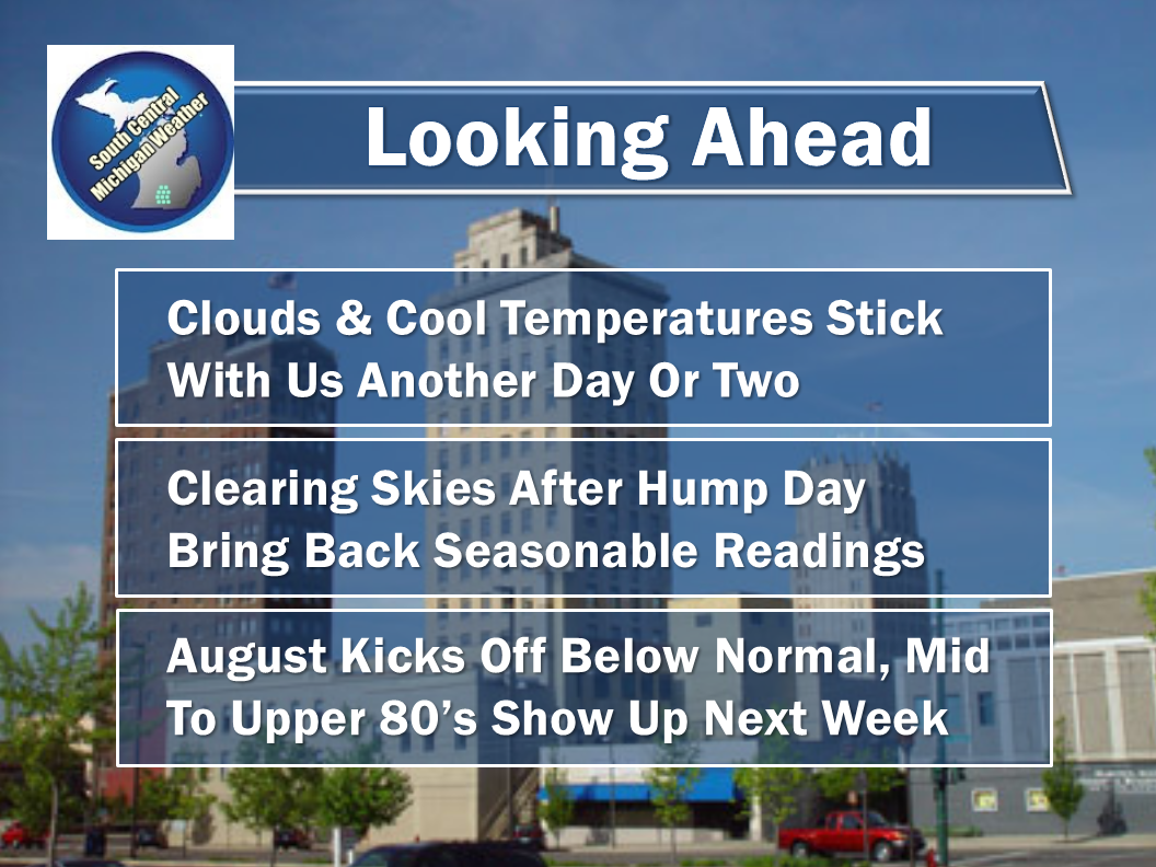
LOOKING AHEAD:


And here's my forecast for South Central Michigan:


The Six Day Planner looks fairly dry in most places, at least until the end of the week:


There's the forecast and the details.  I hope that you have a wonderful day!  Blessings.

Friday, August 1, 2014

SEVERE THUNDERSTORM WARNING CLINTON, INGHAM

THE NATIONAL WEATHER SERVICE IN GRAND RAPIDS HAS ISSUED A
* SEVERE THUNDERSTORM WARNING FOR...
SOUTHEASTERN CLINTON COUNTY IN SOUTH CENTRAL MICHIGAN...
NORTHWESTERN INGHAM COUNTY IN SOUTH CENTRAL MICHIGAN...
* UNTIL 500 PM EDT
* AT 353 PM EDT...A SEVERE THUNDERSTORM WAS LOCATED NEAR LANSING...
AND MOVING EAST AT 10 MPH.
HAZARD...60 MPH WIND GUSTS AND QUARTER SIZE HAIL.
SOURCE...RADAR INDICATED.
IMPACT...HAIL DAMAGE TO VEHICLES IS EXPECTED. EXPECT WIND DAMAGE TO
ROOFS...SIDING AND TREES.
* LOCATIONS IMPACTED INCLUDE...
LANSING...            WHEATFIELD TWP...     HOLT...
HASLETT...            OKEMOS...             EAST LANSING...
SLEEPY HOLLOW STATE PARK...                 BATH...
FOREST HILLS...       MERIDIAN...
...1.00IN
WIND...60MPH

Tuesday, July 29, 2014

A Bit Of Popcorn...

Good Afternoon!

Here's a look at the pop-up showers and storms that I mentioned in the forecast this morning:


Some of these will have up to dime-sized hail and winds up to 40 MPH in them.  They should start to die off as the sun goes down and the air becomes stable once again.

Fall Preview Continues...Milder Weather In Sight

Good Morning!

A primarily gray day as we head into lunchtime here in Michigan!  Plenty of clouds and cool temperatures for the masses:


If you're looking for 70 or better you have to head all the way to Grand Rapids or Ypsilanti before you find them!

COOL PATTERN CONTINUES:  All of the major players from yesterday are still more or less in their same positions.  As you'd expect, that means the weather stays fairly constant.  Ridging west, trough east that is sagging well down into the Tennessee valley, bringing unusually cool weather to much of the world that is typically baking this time of the year.  Here's a look at the national temperatures:


The upper low north of us in Canada is parked and rotating, pulling cool Canadian down here on it's rear flank.  I don't expect that thing to move a whole lot over the next day or so, therefore I don't see and huge changes to the pattern.  We will see the heat that is bottled up out west nudging as it wants to come this way, but all indications are that it will be held off.  The good news there is no serious heat returning for awhile.  We'll make it back to seasonable levels, sure, but nothing scorching in the cards 9at this moment.

PESKY RAIN CHANCES THE NEXT FEW DAYS:  Another dimension to this setup is the low end rain probabilities that stick with us for the next several days.  Have a look at the Storm Prediction Center maps...


Because of how everything is set, we can't shake the chance of some afternoon instability touching off some showers or even an isolated thunderstorm.  Nothing widespread, these will be hit and miss, more miss.  A smaller percentage of those areas that do see rain could see thunderstorms that may hide some pea to dime-sized hail.  Aside from that, highest chances of any one spot getting wet top out at three in ten.  Look at this graphic:

From 3 until about 7 or 8 PM, the Hi-res NAM forecast model likes some light showers in this area, with heavier activity off to the north.  I don't really think the radar will look exactly like this at 3 PM, but know that some raindrops are expected.

NOT A LOT OF RAIN HERE:  Let's have a look at the Weather Prediction Center 5 Day Rain Forecast:

As you can see, even with all the clouds and such that I expect to hang around like a bad cold, there's not much rain in them.  Only about a half-inch of rain on the high side expected in this part of the world through Saturday.

With all of that out of the way...


And here's the forecast:


And the extended outlook:


I hope you have a great Tuesday!  Blessings.

Monday, July 28, 2014

July Cools Out...

Good Morning!

After a busy day yesterday where all kinds of warning boxes were on the map for severe thunderstorms, along with a couple of tornado warnings well north of us in northern lower Michigan, quiet and cool are the words for the next few days.  Let's have a look.

COOLER:  Much lower humidity and dew point readings are evident this morning, along with much lower temperatures.  Looking at the water vapor satellite image, you can see the drier air in the Midwest, along with the clouds...


Even with the drier air, mainly cloudy skies will be the rule today as a definite ridge west/trough east setup is apparent, allowing cool Canadian air to sit with us for a bit.  A lot of temperature readings north of the border at this hour are in the upper 40's!  Lower 50's in this area now.  Temperatures this week will run cool, with the average reading in this part of Michigan around 83, we'll be as cool as 74 for daytime highs through Wednesday!  Talk about mild and refreshing.

STILL SOME RAIN CHANCES EACH DAY:  Thanks to a low well north of the border in Canada, there's disturbances rotating through the upper air pattern.  These will keep us variably cloudy, along with adding a few scattered showers and perhaps a thunderstorm.  The Storm Prediction Center has us under a "see text" mention for tomorrow, and looking at the details, they're discussing the possibility of some isolated small hail, as storms could fire due to an upper low sitting in the vicinity combined with some surface heating.


I'm honestly looking at this setup as "iffy", just based on the quality of the air in the area for the next day or two, plus the fact that there's nothing to really force atmosphere - the air is fairly cool and stable.  At best, I'm calling for a 3 in 10 chance of an isolated or widely scattered shower or storm.  Most places in the area will see some blended sunshine.  Nothing severe on the table for the next three days.  Let's have a peek at the Weather Prediction Center 5 Day Outlook:


As you can see, a half-inch or less until you get up around Gaylord and Grayling, where the computers are suggesting up to an inch of rain to fall.  Again, the best chances of this will be tomorrow and then again on Friday.

LOOKING AHEAD:


There's a look at your current picture and my forecast for Jackson and South Central Michigan.  Blessings. I hope you have a fantastic Monday!


Sunday, July 27, 2014

Watches Expiring

The National Weather Service is slowly but surely pulling the plug on the severe weather watches in Michigan.  This map shows the current Severe Thunderstorm Watches still in effect.  Originally this was supposed to last until 9 PM, but with the cooler, more stable air left in the wake of the thunderstorms, the watches are being killed ahead of schedule.


Only the far eastern counties in Michigan have a shot at having their watches last until 9 PM, as most of the rough weather has departed east.

SEVERE THUNDERSTORM WARNING - CLINTON, LIVINGSTON, N. WASHTENAW, NE JACKSON

THE NATIONAL WEATHER SERVICE IN DETROIT/PONTIAC HAS ISSUED A  
  
* SEVERE THUNDERSTORM WARNING FOR...  
  SOUTHERN LIVINGSTON COUNTY IN SOUTHEAST MICHIGAN...  
  NORTHERN WASHTENAW COUNTY IN SOUTHEAST MICHIGAN...  
  
* UNTIL 730 PM EDT  
  
* AT 624 PM EDT...SEVERE THUNDERSTORMS WERE LOCATED ALONG A LINE  
  EXTENDING FROM 7 MILES NORTHWEST OF STOCKBRIDGE TO STOCKBRIDGE TO  
  GRASS LAKE...AND MOVING EAST AT 40 MPH.  
  
  HAZARD...60 MPH WIND GUSTS.  
  
  SOURCE...RADAR INDICATED.  
  
  IMPACT...EXPECT DAMAGE TO ROOFS...SIDING AND TREES.  
  
* SEVERE THUNDERSTORMS WILL BE NEAR...  
  PARKERS CORNERS AND HELL AROUND 635 PM EDT.  
  PINCKNEY STATE RECREATION AREA AND PINCKNEY AROUND 640 PM EDT.  
  HUDSON MILLS METROPARK AND HUDSON MILLS AROUND 645 PM EDT.  
  HOWELL AND LAKELAND AROUND 650 PM EDT.  
  BARTON HILLS AND WHITMORE LAKE AROUND 655 PM EDT.  
  ISLAND LAKE STATE RECREATION AREA AND BRIGHTON AROUND 700 PM EDT.  
  
THE WARNING INCLUDES AREAS SURROUNDING THESE LOCATIONS...  
  DIXBORO...            WHITMORE LAKE...      SALEM...  
  PINCKNEY...           HOWELL...             HARTLAND...  
  HAMBURG...            GREGORY...            DEXTER...  
  CHELSEA...            BRIGHTON...           ANN ARBOR...  
  
PRECAUTIONARY/PREPAREDNESS ACTIONS...  
  
FOR YOUR PROTECTION MOVE TO AN INTERIOR ROOM ON THE LOWEST FLOOR OF A BUILDING.  
  
THE NATIONAL WEATHER SERVICE IN GRAND RAPIDS HAS ISSUED A  
  
* SEVERE THUNDERSTORM WARNING FOR...  
  CLINTON COUNTY IN SOUTH CENTRAL MICHIGAN...  
  IONIA COUNTY IN SOUTH CENTRAL MICHIGAN...  
  
* UNTIL 700 PM EDT  
  
* AT 557 PM EDT...A SEVERE THUNDERSTORM WAS LOCATED NEAR MUIR...AND  
  MOVING EAST AT 30 MPH. ANOTHER STRONG STORM WAS NEAR BELDING.   
  
  HAZARD...60 MPH WIND GUSTS AND QUARTER SIZE HAIL.  
  
  SOURCE...RADAR INDICATED.  
  
  IMPACT...HAIL DAMAGE TO VEHICLES IS EXPECTED. EXPECT WIND DAMAGE TO  
           ROOFS...SIDING AND TREES.  
  
* LOCATIONS IMPACTED INCLUDE...  
  IONIA...              HUBBARDSTON...        SARANAC...  
  LAKE ODESSA...        BELDING...            PORTLAND...  
  DEWITT...             BERLIN CENTER...      MUIR...  
  ORLEANS...            SMYRNA...             LYONS...  
  PALO...               PEWAMO...             CLARKSVILLE...  
  RILEY...              WACOUSTA...           BATH...  
  
PRECAUTIONARY/PREPAREDNESS ACTIONS...  
  
FOR YOUR PROTECTION MOVE TO AN INTERIOR ROOM ON THE LOWEST FLOOR OF A BUILDING.


SEVERE THUNDERSTORM WARNING - WASHTENAW

THE NATIONAL WEATHER SERVICE IN DETROIT/PONTIAC HAS ISSUED A  
  
* SEVERE THUNDERSTORM WARNING FOR...  
  SOUTHERN WASHTENAW COUNTY IN SOUTHEAST MICHIGAN...  
  
* UNTIL 715 PM EDT  
  
* AT 617 PM EDT...A SEVERE THUNDERSTORM WAS LOCATED NEAR  
  MANCHESTER...AND MOVING EAST AT 35 MPH.  
  
  HAZARD...60 MPH WIND GUSTS AND QUARTER SIZE HAIL.  
  
  SOURCE...RADAR INDICATED.  
  
  IMPACT...HAIL DAMAGE TO VEHICLES IS EXPECTED. EXPECT WIND DAMAGE TO  
           ROOFS...SIDING AND TREES.  
  
* THE SEVERE THUNDERSTORM WILL BE NEAR...  
  MANCHESTER AROUND 625 PM EDT.  
  PLEASANT LAKE AROUND 630 PM EDT.  
  BRIDGEWATER AROUND 635 PM EDT.  
  SALINE AROUND 645 PM EDT.  
  PITTSFIELD TOWNSHIP AND MILAN AROUND 655 PM EDT.  
  YPSILANTI AROUND 700 PM EDT.  
  
THE WARNING INCLUDES AREAS SURROUNDING THESE LOCATIONS...  
  WILLIS...             YPSILANTI...          SALINE...  
  MILAN...              MANCHESTER...  
  
PRECAUTIONARY/PREPAREDNESS ACTIONS...  
  
FOR YOUR PROTECTION MOVE TO AN INTERIOR ROOM ON THE LOWEST FLOOR OF A 
BUILDING.  
  

SEVERE THUNDERSTORM WARNING CLINTON, JACKSON, LENAWEE

The Severe Thunderstorm Warning are being extended east across the area - have a look:


Both warnings expire at 6:45.  Head inside, prepare for winds up to 60 MPH and up to quarter sized hail.

SEVERE STORMS APLENTY

Finally have gotten to the blog instead of just Facebook and Twitter.  Here's the latest:


THE NATIONAL WEATHER SERVICE IN GRAND RAPIDS HAS ISSUED A  
  
* SEVERE THUNDERSTORM WARNING FOR...  
  CALHOUN COUNTY IN SOUTH CENTRAL MICHIGAN...  
  SOUTHERN KALAMAZOO COUNTY IN SOUTHWEST MICHIGAN...  
  
* UNTIL 600 PM EDT  
  
* AT 458 PM EDT...SEVERE THUNDERSTORMS WERE LOCATED ALONG A LINE  
  EXTENDING FROM SPRINGFIELD TO KALAMAZOO...AND MOVING EAST AT 45  
  MPH.  
  
  HAZARD...GOLF BALL SIZE HAIL AND 60 MPH WIND GUSTS.  
  
  SOURCE...RADAR INDICATED.  
  
  IMPACT...PEOPLE AND ANIMALS OUTDOORS WILL BE INJURED. EXPECT HAIL  
           DAMAGE TO ROOFS...SIDING...WINDOWS AND VEHICLES. EXPECT  
           WIND DAMAGE TO ROOFS...SIDING AND TREES.  
  
* LOCATIONS IMPACTED INCLUDE...  
  KALAMAZOO...          BATTLE CREEK...       SCHOOLCRAFT...  
  TEKONSHA...           MARSHALL...           ALBION...  
  OSHTEMO...            GALESBURG...          FULTON...  
  PORTAGE...            CLIMAX...             VICKSBURG...  
  CONVIS TWP...         LEE TWP...            BABCOCK...  
  CERESCO...            BEDFORD...            SPRINGFIELD...  
  
PRECAUTIONARY/PREPAREDNESS ACTIONS...  
  
FOR YOUR PROTECTION MOVE TO AN INTERIOR ROOM ON THE LOWEST FLOOR OF A BUILDING.  

THE NATIONAL WEATHER SERVICE IN GRAND RAPIDS HAS ISSUED A  
  
* SEVERE THUNDERSTORM WARNING FOR...  
  SOUTHEASTERN EATON COUNTY IN SOUTH CENTRAL MICHIGAN...  
  SOUTHERN INGHAM COUNTY IN SOUTH CENTRAL MICHIGAN...  
  JACKSON COUNTY IN SOUTH CENTRAL MICHIGAN...  
  
* UNTIL 645 PM EDT  
  
* AT 539 PM EDT...SEVERE THUNDERSTORMS WERE LOCATED ALONG A LINE  
  EXTENDING FROM CHARLOTTE TO ALBION...AND MOVING EAST AT 40 MPH.  
  
  HAZARD...60 MPH WIND GUSTS AND QUARTER SIZE HAIL.  
  
  SOURCE...RADAR INDICATED.  
  
  IMPACT...HAIL DAMAGE TO VEHICLES IS EXPECTED. EXPECT WIND DAMAGE TO  
           ROOFS...SIDING AND TREES.  
  
* LOCATIONS IMPACTED INCLUDE...  
  JACKSON...            CHARLOTTE...          SPRINGPORT...  
  GRASS LAKE...         CONCORD...            BROOKLYN...  
  STOCKBRIDGE...        LESLIE...             MASON...  
  EATON RAPIDS...       CLARK LAKE...         WATERLOO TWP...  
  LIBERTY TWP...        MICHIGAN CENTER...    TOMPKINS...  
  VANDERCOOK LAKE...    HORTON...             SANDSTONE...  
  
PRECAUTIONARY/PREPAREDNESS ACTIONS...  
  
FOR YOUR PROTECTION MOVE TO AN INTERIOR ROOM ON THE LOWEST FLOOR OF A 
BUILDING.  

SEVERE THUNDERSTORM WATCH

The National Weather Service Has issued a Severe Thunderstorm Watch for all counties in the blog until 9 PM.  Stay weather aware.  Today is my birthday, but as soon as I do the cake and ice cream bit with my daughter and get her pool fully re-inflated, I'll dive in and let you know what's going on.