Saturday, December 14, 2013

WINTER STORM WARNING - LENAWEE

The National Weather Service in Detroit has issued a Winter Storm Warning for Lenawee, Wayne and Monroe Counties until Midnight.

...Up To Eight Inches Of Snow Expected South Of I-94...Moderate Snow...Occasionally Heavy Toward The Ohio Border Will Continue To Fall Through The Day...Tapering Off During The Evening Hours.
Total Snowfall Accumulations Of 4 To 8 Inches Are Expected South Of M-59...With The Highest Totals Occurring South Of I-94. North Of M-59...2 To 5 Inches Is Expected.
Hazardous Weather...
* Moderate Snow...Occasionaly Heavy At Times..Will Fall This Afternoon...Tapering Off This Evening.
* Total Snowfall Of 5 To 8 Inches Is Expected...Highest Totals Near The Ohio Border.
* East Winds Gusting Around 20 Mph Will Continue Through The Day...Causing Some Lowing And Drifting Of The Snow.
Impacts...
* Untreated Roads Will Be Snow Covered And Slippery.
* Visibilities Will Be Reduced To Between A Quarter And Half A Mile At Times.
* Blowing And Drifting Snow Will Occur Along North-South Roads In Open Areas.

Winter Weather Continues

Snow keeps failing in Michigan at this hour, you can expect upwards of 6" before it's done.  The range of 3" to 6" still looks good.  Lenawee County is now under a Winter Storm Warning.  Details to follow...

Friday, December 13, 2013

WINTER WEATHER ADVISORY

Good Morning!

Just a quick note to alert you of the Winter Weather Advisory that will be forthcoming from the National Weather Service.  It looks like Calhoun, Jackson, Eaton, Ingham and perhaps Clinton should get ready for up to 5" of snow. Details later.

Thursday, December 12, 2013

Thursday Forecast...

Here's the forecast for Jackson and vicinity:


Have a wonderful day!  Blessings.

A Touch Less Snow Saturday?

Good Morning!

The forecast is about up, but before I post that, I wanted to tell you that I have been looking at the snow event forecast for Saturday, and I have some news - forecast model data has come around to a less snowy solution than what I was seeing earlier this week.  Have a look at this:

This is what the NAM forecast model thinks the radar will look like at 11 AM on Saturday.  Notice the pocket of heavier snow along the I-94/I-69 corridor. 
Forecast models are thinking 2 to 4 inches of snow for this event, we'll see as we look at data today, I'm sure that guess will be refined as we get closer.  Based on the consensus between multiple models though, that amount is starting to look really good.  We'll keep you posted.

Wednesday, December 11, 2013

Quick Look Ahead

Hey Gang!

After some pretty significant changes, here's the forecast for Jackson and surrounding areas including Parma and Rives Junction:


Have a wonderful day!  Blessings.

Sneaky Lake Effect...

Good Morning!

Changes in the forecast are/were clearly needed due to the lake effect getting more energetic.  Here's the first of the corrected graphics, though I'm sure most people are on the way or already into work...


More forecast on the way!

WINTER WEATHER ADVISORY - CALHOUN, EATON

The National Weather Service in Grand Rapids has issued a:

WINTER WEATHER ADVISORY FOR LAKE ENHANCED SNOW...WHICH IS IN EFFECT FROM
MIDNIGHT TONIGHT TO 5 PM EST WEDNESDAY.

HAZARDOUS WEATHER...

 * SNOW WILL CONTINUE THROUGH THIS EVENING...BUT A MARKED INCREASE
   IN INTENSITY IS EXPECTED OVERNIGHT INTO WEDNESDAY MORNING.

 * SNOWFALL AMOUNTS OF 3 TO 6 INCHES WILL BE POSSIBLE BY LATE
   WEDNESDAY AFTERNOON.

 * VISIBILITY WILL BE SIGNIFICANTLY REDUCED...TO NEAR ZERO AT
   TIMES...IN THE HEAVIER SNOW BANDS.

IMPACTS...

 * SNOW COVERED AND SLIPPERY ROADS ARE ANTICIPATED.

 * IN THE HEAVIER SNOW BANDS LATE TONIGHT AND WEDNESDAY MORNING
   VISIBILITY WILL BE REDUCED TO NEAR ZERO AT TIMES.

PRECAUTIONARY/PREPAREDNESS ACTIONS...

 * SNOW WILL RAMP UP IN INTENSITY TONIGHT WITH A STRONG LAKE
   ENHANCED SNOW BAND EXPECTED TO DEVELOP ACROSS THE AREA LATER
   TONIGHT. BE PREPARED TO ENCOUNTER RAPIDLY CHANGING CONDITIONS
   IF TRAVELING.

 * FALLING SNOW AND SLIPPERY ROADS WILL NECESSITATE YOU ALLOWING
   EXTRA TIME TO REACH YOUR DESTINATION...ESPECIALLY DURING THE
   MORNING COMMUTE.

Be safe tonight and tomorrow.  Full details in future posts.

Tuesday, December 10, 2013

Winter Is On...Snow Machine Cranking Up...

Good Morning!

Old Man Winter has us firmly in his clutches now, and it doesn't look like he will be letting go anytime in the next few days.  Plenty of icy air from Canada in the area.  Let's have a look and see what we can expect:

YOU SAID THE BITTER COLD WOULDN'T GET US - WHAT HAPPENED? - I busted on that part of my forecast.  More specifically, I didn't account for the trough that we are in diving as far south into the US as it has.  There's nothing but Arctic air behind it, plain and simple.  Have a look at the surface readings around the nation:

Old Man Winter is sharing the cold stuff with most of the nation!
While we won't see air temperatures drop into the sub-zero range, the wind chills will make up for that.  Additionally, the snow on the ground here and northwest of us won't help matters much either.  It will chill any milder air that tries to make it this way, and that's a pattern that should hold for awhile.

HOW MUCH MORE SNOW CAN WE EXPECT? - In a word, it depends on where you are.  If you're in or traveling toward the snow box, you can expect fairly steady accumulating lake effect snow for the next few days.  Inland, we stand to pick up about an inch, perhaps two, between now and Friday.  Forecast model data indicates this big cold trough isn't going anywhere.  There's some bubbles of high pressure that will be steered through the larger upper air flow, and in between those, some upper disturbances working through -- Alberta Clippers.  If we were still in the warm season, these disturbances would cloud you up and touch off some scattered showers.  This time of year, they bring you some light snow, and typically you get at least a bit of accumulation out of them.

The day I'm keeping an eye on is Saturday, as we get low pressure coming out of north Texas and tracking fairly due east until it gets near the Appalachians, where it hangs a dogleg left.  That thing looks to bring some sustained snow to south central Michigan, adding up to a couple to four inches in many spots.  Have a look at the Weather Prediction Center 5 Day precipitation forecast...

This map is good thru 7 AM Sunday Morning.  Don't be shocked to see the totals climb some.
WPC only likes a half-inch of liquid precipitation between now and Sunday, but for my money, I really think that figure increases as we get closer to the weekend, making snow totals go up as well.

BEYOND THE WEEKEND:  Once we get through the weekend, more cold weather until perhaps Tuesday, when models say a pattern reset is in order, bringing us back up to temperatures around freezing as we finally turn the freezer down some, even if we can't shut the door for awhile.

Here's the forecast for Jackson and surrounding areas including Leslie and Napoleon:


Have a wonderful day!  Blessings.

Cold Start To The Day

Good Morning!

It's a cold start to a stretch of cold days here in Michigan.  Just look at this list of wind chill readings at 9:30 AM around the state:


Forecast on the way...

Monday, December 9, 2013

Quick Look For Tuesday...

Hey Gang!

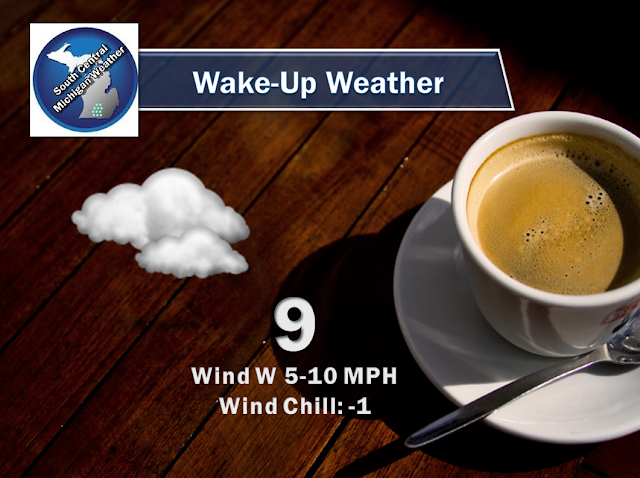
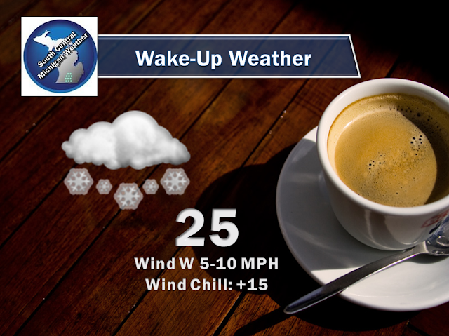
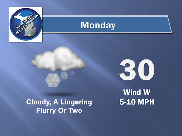
I tell you what - that cold air that I said didn't look like it would make it in but for a brief stay Tuesday?  That was wishful thinking on mine and the forecast models part.  I told you this weather bit will keep you humble.  You can expect a bit of a stay in the deep freeze, more so wind chill driven than actual air temperature driven, but who cares?  It's going to be COLD out there.  Here's the wake up weather and forecast for tomorrow.


Stay warm, I will try to make more sense of this for you tomorrow!

Really Cold Close By...

Hello!

I said that nasty cold air wouldn't get to us.  I suppose you could say my forecast busted after a fashion.  The air temperatures aren't what they are to the west, but the wind chills make it so that you wouldn't care - it feels brutally cold!  Have a look...


Only four reporting stations in Michigan currently with double digit positive wind chills.  Everyone else is either single digits or in the hole.  Needless to say, bundle up if you must venture outdoors.  Otherwise stay inside!

Sunday, December 8, 2013

Wake-Up Weather

Here's a look at your morning weather picture:


What The Heck Is A Snow Box?

Hello Gang!

I thought I would take a minute to clarify one of my pet phrases that you'll see in my winter forecasts this year.  I use it because it's quicker typing, and people can make a mental connection with a shape bounded by some sort of lines.  Allow me to introduce the snow box.  Look at this graphic to see what I mean:


Now I must tell you that this DOES NOT always hold true.  Lake effect snow can happen anywhere up and down the lake shore, and inland as much as 100 miles or so.  It all depends on atmospheric setup and wind direction, among other things.  For instance, I left Benton Harbor out of the snow box, but they see their fair share, and sometimes more.  This box represents the best chances for accumulating snow beyond an inch or two during a lake effect snow situation.  The snow bands can also hold it together and be pushed east by winds aloft, thus dropping a couple to four inches of snow (sometimes more) as far east as the US-127 corridor (Lansing, Mason, Leslie, Jackson).

So when you see me speak of the snow box in the future, you know where I am talking about, and that I am thinking of heavier snowfall in this part of the state.

Take care!  Details on the snow in the area forthcoming.

Snowy and Cold -- No Deep Freeze Yet...

Good Afternoon!

It feels good to be able to get in front of the computer again and do a little bit of forecasting and writing for you.  Time is so short these days, and trying to squeeze in sleep around two jobs...challenging.  Anyway, weather...it's snowing.  If it's not already it will be by nightfall.  I'm sure you've heard or seen this somewhere by now.  If you haven't, you can expect a half-inch or so of snow, especially along and south of I-94.  Let's have a closer look and see what's going on and what we can expect.

THE FREEZER DOOR IS OPEN, NO DEEP FREEZE YET (NOT HERE ANYWAY):  We'll see temperatures get seasonably cold over the next few days, thankfully I don't see the bitterly cold air in the northern Plains edging it's way in here until a brief appearance Thursday.  Have a look at these maps and you'll see what I mean:


Combine that with the snow that is falling and you'll set the tone for the holiday season, white Christmas, all of it.

SOME SNOW, ENOUGH TO MAKE TRAVEL TRICKY:  No winter storms afoot now which is good, but there is some snow falling, and you can expect up to a half-inch tonight, and about an inch between now and the middle of the week.  Heavier amounts will fall in the snow box over by the lake.  This snow tonight will slicken roads and cause some headaches, especially on untreated surfaces.  Be careful tonight, allow some extra time to drive into work tomorrow, and you'll be fine.  Have a look at the radar composite to see what we're talking about:


Computer forecast models are all saying that after this snow comes and goes, we stay fairly quiet until Wednesday.  That being said, I really think almost any day this week, we'll have the chance at some flurries or even a bit of light snow.  The best chances of that after tonight will be Wednesday and Saturday, with Saturday's event possibly leaving us a couple of inches of snow.

LOOKING AHEAD:  Not much on tap beyond your typical winter weather pattern minus heavy-duty snowfall.  Average temperature around these parts this time of year is 35, so we'll be running below normal right through the weekend.  We see a bit of a warmup as we get to the week before Christmas, but that may also bring in more snow.  We'll keep you posted.

Here's the forecast for Jackson and vicinity:


There's a look at your forecast, have a great night.