After a busy day with church and working the straight job, I finally have the chance to sit and pore over some data and modeling, and I can sum it up in one word...HOT. As much as I hate to say this, it sure looks like we are poised to be thrust into the oven again, at least for tomorrow. This will be a little different than previous trips to the blast furnace for South Central Michigan though...Let's pop the hood and see what's running under there.
TEMPERATURES: We'll see temperatures climb into the mid 90's for tomorrow, with dewpoint values into the 70's that will allow the heat index to make a run at 100. The heat dome is trying to elbow it's way back in here, and modeling indicates that we'll be on the cusp of it. After tomorrow, we'll see temperatures start easing off through the balance of the week, as it looks like we get some help from an unusual source...RAIN. Rain-cooled air is a definite possibility based on the setup. I'll have more for you about the "Ring Of Fire" in another post.
RAIN: I surely hope that I am not jinxing it for us, but things are shaping up for us to have multiple shots at some needed, beneficial rain as early as daybreak tomorrow. With us sitting right at the cusp of the ridge and heat dome, we're in good position to catch upper waves and disturbances sliding off the back side of the ridge. Each one that come through gives us a chance at some showers and thunderstorms, and given the heat and humidity, I don't think the moist, unstable air that thunderstorms love to nosh on will be lacking.
The National Weather Service is also thinking along similar lines, here's their forecast map regarding precipitation for the next five days...
 |
| 5 Day Precipitation Forecast |
That's the juiciest map I have seen in quite awhile for rain chances! That 3 inch bullseye over by Port Huron looks especially good given the drought conditions we are currently experiencing. Here in the blog area, I'm thinking we'll top out at a little over two inches. If I am too low with that prediction, so much the better! Our best shots at rain come during the early and middle parts of the week, with a clearing trend setting up in time for the weekend. Here's a look at the GFS computer model valid at 5AM tomorrow, showing the setup for the day...
 |
| GFS Computer Model Forecast for Monday 7/23, valid at 5AM EDT |
SEVERE WEATHER: The Storm Prediction Center has us under a "slight" risk for severe storms tomorrow. The biggest threat that we need to be concerned about is for wind and hail. Here's a look at the forecast map from SPC:
 |
| Severe Weather Forecast Valid 8AM EDT 7/23/12 |
As you see, a slight risk for us, then down into the Ohio Valley, and then back up through the Appalachians and into New England, along with a second area way out west in Montana and the extreme west Dakotas.
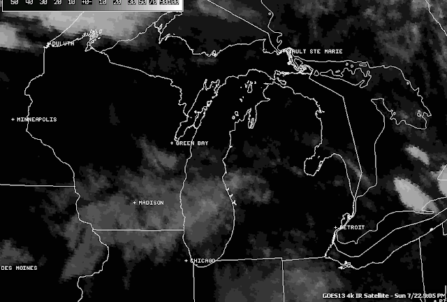
Here's a look at the infrared satellite, just some passing clouds and some shower activity over Lake Michigan:
 |
| Infrared Satellite Image |
Here's the local forecast for Jackson County:
For tonight, periods of clouds and stars, muggy, a chance at an isolated or widely scattered shower or storm, lows only down to 69, winds SW 5-10 MPH.
Tomorrow, a mixture of clouds and sunshine, a chance of widely scattered to scattered showers and thunderstorms in the afternoon, hot with a high of 94, winds SW 7-13 MPH.
Monday night, continued muggy and warm under cloudy skies with a chance of showers and thunderstorms, low 68. Winds turn NNW 5-10 MPH.
Tuesday, periods of clouds and sunshine, not as warm or humid, high 88, winds NE 5-10 MPH.
Wednesday, partly sunny skies, chance of a scattered shower or thunderstorm, high 84.
Thursday, mostly cloudy, a few peeks of sunshine, chance of scattered showers or a thunderstorm, high 83.
Friday, mostly sunny skies with a few passing clouds, high 82.
There's a look at your forecast for the next six days, i do hope that you have a great evening and a good day tomorrow! Blessings.
No comments:
Post a Comment