A blend of clouds and sun in South Central Michigan at this hour, at least until you get into the southern tier of counties along the state line, where it is mainly clear right now with temperatures at or near 30 across the board. The clouds in the north zone are thanks to some lake-effect snow off to the northwest that is affecting mainly Muskegon, Big Rapids and areas on over to Mount Pleasant. Let's take a deeper dive and see what we have going in this part of the world:
SUMMARY: Fairly quiet in the area now and for the next few days, with a warming trend until Saturday evening,then to bottom falls out of the thermometer and we get shoved into the freezer. Expect temperatures to fall almost 25 degrees and settle in the teens or low 20's in most places for Sunday.
We'll see an unseasonably mild high of 40 tomorrow, after we make it to about 30 today, so don't expect a whole lot of movement of the mercury today. The quick warming happens as we get to the back side of a high that is riding in the jet stream, which is currently running right over Michigan. That high has wind spinning clockwise around itself while it moves within the bigger and faster jet stream, so as it moves to the north of us, it will make the winds near the surface swing to the southwest, pulling milder air up from the south.
That all passes us, then winds swing back northwest, and the cold air kicks the door in and rushes us, sending the mercury toward zero over night early next week. Look at this map of surface temperatures:

If you're looking for any temperatures above freezing, forget about it through the end of next week.
PRECIPITATION: Based on what I just explained above, I really don't see much falling out of the sky in this area, with the exception of maybe a few flurries when the cold air barrels in Saturday night. If you're headed over to West Michigan, you'll want to tuck away in mind the chance of some lake-effect snow from US-131 west to the shore, but other than that, for my money, we stay quiet. Take a look at this map, which is the National Weather Service precipitation forecast map for the next five days:

As you can see, a quarter inch of liquid tops for the next five days, and I can buy that. You have to remember that computer forecast models don't do all that well with things like lake-effect snow, because the ingredients that have to be in the pot to make that happen are so precise. This is the forecast models saying we see low risk for snow and we can't get more specific than that.
Here's the satellite and Grand Rapids NEXRAD images:
 |
| Visible Satellite Image |
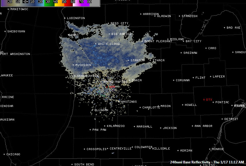 |
| Grand Rapids NEXRAD Radar Reflectivity |
Today, periods of clouds and sun, seasonable, high 35, winds NW 6-12 MPH.
Tonight, partly to mostly cloudy skies, cold, lows near 16, wind SW 7-14 MPH, wind chills could reach -2 in some areas!
Friday, more clouds than sunshine, windy, with a high of 34, wind SW 10-20 MPH, wind chills will stay around 20 degrees.
Friday night, mainly cloudy, not as cold, low near 27. Wind SW 10-20 MPH, wind chills near 10 degrees are likely.
Saturday, partly sunny, unseasonably mild, high 40.
Sunday, some mixed sunshine, sharply colder, perhaps a few flurries as the cold air pours in, high 20.
Monday, partly to mostly cloudy skies, colder still, high only 15. Nighttime wind chills could reach or exceed -10.
Tuesday, continued partly cloudy, just a touch warmer, a few stray flurries may be about, high only 16.
Wednesday, clouds persist with some breaks for sunshine, a few degrees warmer again, high climbs to 22.
Thursday, a mix of clouds and sunshine, back to seasonable conditions, high 30.
There's a look at your forecast for the next six days, I do hope that you have a great day! Blessings.
No comments:
Post a Comment