A lot quieter in Jackson and South Central Michigan after a line of pre-dawn storms blew through the area, bringing heavy rain, hail, and high winds to some locations this morning. We don't expect anything like that for the rest of today. Let's pop the hood and see what we have to work with today...
TEMPERATURES: The pattern that I discussed yesterday still looks good for the next several days, that being temperatures climbing to the mid or even upper 80's during the day and falling back into the lower 60's during the nighttime hours. The truly oppressive heat still stays bottled up in the southern Plains and we still get the "ridge rider" storms coming in periodically, when the boundary between the warm air and the truly miserable hot air edges close enough to us to work with disturbances and lows moving across the Lower Peninsula. Now the GFS forecast model is suggesting a 90 for Saturday, but it's a little early to lock that in just yet. Another model run, maybe two, and we'll see if the 90 mark gets tossed into the forecast.
RAIN: Unofficially, Jackson has picked up .12 of an inch, and Lansing almost doubled that, coming in with just under a quarter-inch at .23 inch of rain. Rain chances have basically ended for the area at this point, and the next quality chance comes later in the week, Thursday evening into Friday. Here's what the National Weather Service thinks about rain for the next five days:
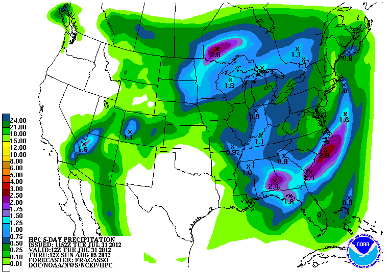 |
| 5 Day Precipitation Forecast |
SEVERE WEATHER: Still pretty quiet, even after the flare-up from this morning. The Storm Prediction Center is only expecting a general risk of garden-variety thunderstorms through today, then quiet tomorrow and Thursday, though I expect the Thursday forecast to change a bit, based solely on model simulations for later in the week.
Here's a look at the Storm Prediction Center map for today. This was updated about 11AM EDT...
 |
| Day 1 Forecast, Storm Prediction Center |
The south zone of the blog is clear, a few puffy clouds north on the visible satellite:
 |
| Visible Satellite Image |
For this afternoon, mainly clear skies with a few passing clouds, high 86, winds NW 5-10 MPH.
Tonight, continued mostly starry skies, a few more clouds float by, lows drop to near 64, winds NW 3-8 MPH.
Wednesday, starts cloudy, then becomes mostly sunny, seasonably warm and pleasant, perhaps a passing cloud as temperatures climb to 86, winds NW 3-8 MPH.
Wednesday night, clear and comfortable, lows roll back to 64, winds turn SW calm to 5 MPH.
Thursday, clouds increase during the day, we bring in a chance of an isolated or widely scattered set of showers, high 87.
Friday, a mix of clouds and sunshine, chance of an isolated or widely scattered shower or roaming thunderstorm after lunchtime, high 88.
Saturday, partly sunny skies, chance of widely scattered or scattered showers and thunderstorms in the afternoon, high 89.
Sunday, cloudy skies, a chance of scattered to numerous showers and thunderstorms, high 83.
That's a look at your forecast for the next six days, i do hope you have a great weekend! Blessings.
No comments:
Post a Comment