I tell you what, rain has been SUCH a tease and in SHORT supply. We get a little bit here and there, and then we get a reasonably organized system approaching us, then it fizzles, or just flat out misses you. The line of showers and thunderstorms did come through and drop a little bit of needed rain. On the back side of that, much cooler weather for the next few days, then temperatures start to warm again in time for the end of the week. Let's take a look at what we have going in the area - one deeper dive coming up!
TEMPERATURES: New computer modeling has shuffled the deck for the weekend. Enjoy the cooling now, because we'll see warm conditions in time for the weekend, including out at Michigan International Speedway for the Alliance Truck Parts 250 and the Quicken Loans 400 on Saturday and Sunday (No, I am not being paid for mentioning the names of the races!). We'll have more on that in the RaceCAST below. Temperatures will roll back into the 70's, then slowly start creeping back up Thursday. Here's temperatures around the nation right now.

RAIN: Yeah, right. The only rain your yard will see in this area is what comes from the sprinklers. The National Weather Service is predicting zip in the way of rain for the next five days, and the models sure line up with that. Hot and dry is the name of the game. Here's a look at the 5 day precipitation map...
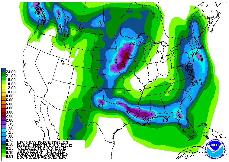
So far the rain deficit is creeping up on the two inch mark...we'll add to that gap over the next several days.
SEVERE WEATHER: No severe weather on tap for Michigan for the next three days. Today is the only day currently with any severe risk anywhere in the US according to the Storm Prediction Center. After that, just 5% probability areas and chances for garden variety thunderstorms.
RaceCAST: Two races, one weekend, lots of fun. Lots of sun as well, along with very warm weather. Temperatures should be in the mid to upper 80's with periods of clouds and sunshine. Of the two days, Sunday will be the warmer of the two, with a forecast high right now of 86. No rain expected, it should be an enjoyable weekend for everyone headed this way to watch the cars "run fast, turn left". Dew points around 60 degrees should yield heat index values at or above 90 degrees, but at the track I would not be surprised to see heat index values in the mid 90's.
Grand Rapids NEXRAD radar is quiet. The clouds are around us, but not over, yielding bright blue skies in south central Michigan at this hour. Here's a look at the local forecast for Jackson and surrounding communities including Napoleon and Spring Arbor.

For today, sunny skies, pleasant, high 76, winds WNW 6-12 MPH.
Tonight, clear skies, very cool, low 45. Winds N 5-10 MPH.
Wednesday, continued sunny, a cloud or two will pass during the day, unseasonably cool, high 71, winds N 5-10 MPH.
Wednesday night, mostly starry skies, a bit warmer, lows 46, winds NE 5-10 MPH.
Thursday, lots of sunshine, seasonably pleasant with a stray cloud or two floating by, high of 78.
Friday, still sunny and warm, high 83.
Saturday, a mix of clouds and sunshine, warm, high 85.
Sunday, periods of clouds and sunshine, very warm, high of 87.
There's a look at your forecast for the next six days. I do hope you have a great Tuesday! Blessings.
No comments:
Post a Comment