After a busy weather day yesterday, things have quieted down somewhat, but they will get busy again in time, with another round of showers and thunder, fortunately not as intense as yesterday. Let's take a deeper dive...
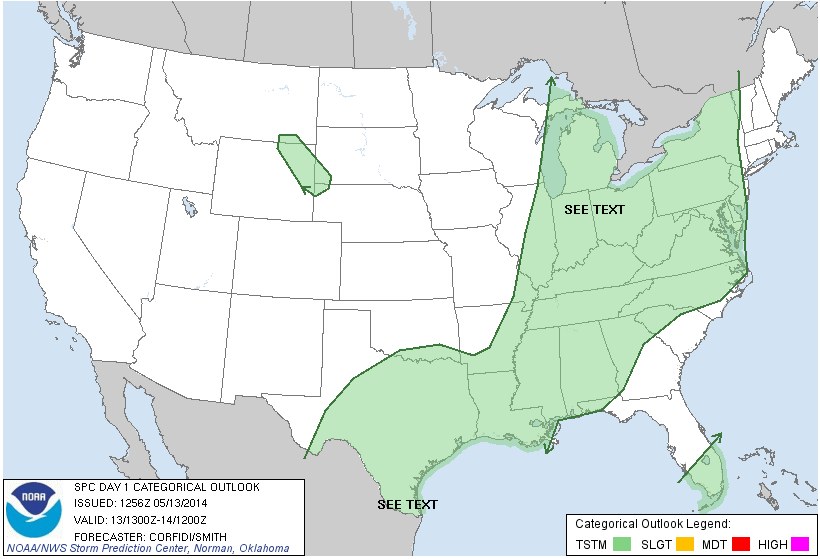
NO HUGE DEAL SEVERE-WISE: Yesterday we were in a "slight" risk for severe weather, and boy did it verify in Washetnaw COunty and points east! Tornado warnings, hail, all of that. Today, things should be much quieter, even if not storm-free. Have a look at the Storm Prediction Center risk map:
 |
| SPC Day 1 Risk Map |
As you can see, just a general risk for garden variety thunderstorms today. That being said, we could see some hail up to pea-size and a some gusty winds as well.
MORNING SUNSHINE, SHOWERS AND A STORM LATER: We note clouds working into the area from the west at this hour on the visible satellite image, as they do, and you combine that with the heating we're getting right now and will continue to get, you can expect some scattered showers and thunderstorms sometime after 2 PM. Even though the air is pretty worked over from all the storms yesterday, thanks to the low-level jet pushing more moisture in ahead of this upper disturbance, it will recover some to support showers and new storms.
A BREAK IN THE ACTION, THEN THE ENCORE: Showers and storms persist into tonight and perhaps as late as morning drive tomorrow, then we see a break in the action until the main weather maker shows up. That's a low tracking northeast from IN/KY/OH, and that's the one that will bring us another round of showers and thunderstorms, but it also bring us sharply cooler weather. I hate to say it, but we are coming to the end of our seasonable weather for a few days. Normal temperatures run into the lower 70's here this time of year, we'll be on the order of 20 degrees cooler! Here's the current temperatures around the nation:

Now have a look at the NAM forecast model futurecast regarding temperatures:
 |
| This is valid Thursday at 8 AM. Nowhere CLOSE to what we're seeing now! |
That's chilly Canadian high pressure! We'll clear the skies and it will feel more like early Spring or even Fall than knocking on the door to Summer with Memorial Day just a couple of weeks away!
RAINS HERE AND THERE: Here's what the Weather Prediction Center thinks regarding rain totals for the next five days:

That's a pretty tight gradient there, showing two things: 1) the better chances for rain and storms will be confined to southeast lower Michigan and 2), those rains will have a bit of intensity with them. Showers and such that form will wring themselves dry fairly effectively over this area. As you track back northwest, the rainfall amounts drop sharply.
Here's the forecast for Jackson and vicinity:


And here's the extended outlook...

Have a great day! Blessings
No comments:
Post a Comment