Good Evening!
It's been far too long since I have updated this blog. I need to figure out how to fit it into my schedule, or close it down. I'll be weighing that decision over the next several days.
What we can weigh in on right now is cooler air as the first night of fall has settled in over us. Let's have a look and see what is going on...
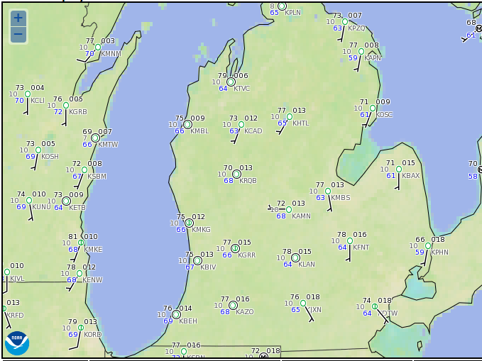
COOLING DOWN IN MICHIGAN: With the exception of a few pockets along the south state line, you can say so long to the 70's soon for awhile. Winds will be swinging around to the northwest as the day progresses Friday, with readings topping out in the upper 60's for the most part, with places like Lansing and Ann Arbor managing to make it up to 71 on the high side. We'll see 60's for the daytime highs starting Tuesday and continuing right thru the forecast window.
WHAT'S CAUSING ALL THIS?: It's Fall y'all! The Autumnal Equinox arrived at 10:21 AM EDT today, ushering in Fall. Seriously, what's causing all this is the change in weather pattern. Northwesterly flow pulls down seasonably cool air from Canada...
This map is the GFS FutureCast in the upper levels at 2 PM. 500 millibars is about 18,000 feet up.You see a ridge still holding on in the eastern part of the nation, extending from central Minnesota down into the Deep South. There's a deep trough digging in the Rockies and a low is nestled in the base. We'll deal with that in time, but for now, just fall-like temperatures. Let's fast-forward thru the weekend and pause at Monday, 2 PM:
Now you see the trough and associated low have progressed east out of the Rockies and across the Great Plains into the Midwest. Ridge is rebuilding in the western states, but as for us, we see an increased chance of shower and thunderstorm activity...
Here you see the low just over the border into Canada. In advance of it, showers and storms along the frontal boundary that should be draped from Michigan down into Tennessee. Just for fun let's look at a bit higher resolution forecast model, the NAM (North American Mesoscale).
The NAM is suggesting a faster timing solution right now, as it is showing the rain and such basically out of lower Michigan by 8 AM Monday morning, which is good news for the AM drive to work or school. Here's another map that shows the expected precipitation the next 5 days, valid thru 8 PM Tuesday:
South Central Michigan looks to pick up about a half inch of rain on the high side with a bit more as you head west toward the lake. I don't expect any major washouts over the next few days.
LOOKING DOWN THE LINE: I expect seasonably mild temperatures in the lower 70's until the storm system works into and through the area on Monday. Once we get on the back side of that, you can forget about 70's for a little while. We aren't done with the mild weather yet, but you'll have no doubt that it's fall. Monday through Wednesday will feature the best chances of precipitation.
Here's the forecast for Jackson and surrounding areas including Michigan Center and Springport.
Today - Mainly cloudy skies with a chance of scattered showers or a pop-up storm. High 73.
Tonight - Continued cloudy, a stray shower may linger, lows near 58.
Saturday - Just an occasional peek of sun, we still can't rule out the chance of a shower. a bit cooler than Friday. High 70.
Sunday - Continued overcast with just the occasional break in the clouds. High 72.
Monday - Cloudy skies with scattered showers and a thunderstorm or two in the PM. High 71.
Tuesday - Clouds still blanket the area, still the mention of a stray shower possible. Cooler. High 61.
Wednesday - Very limited sunshine, an isolated shower possible, High only 60.
Thursday - Partly to mainly cloudy, continued seasonably cool. High 62.
There's your forecast, I hope that you have a great Friday! Blessings.
Friday, September 23, 2016
Wednesday, September 7, 2016
Cooling Down & Damp...
Good Morning!
A warm day on tap for South Central Michigan today, west Michigan could see some severe weather this afternoon and evening. Let's get into it all and see what we have...
SEVERE RISK TODAY: Not a very big risk mind you, but I will mention it here for you. Low end, "marginal" risk for the west end of the blog, with the part of that concerning the blog confined to Branch, Calhoun, Eaton, and Clinton counties...
Some scattered PM showers and storms with marginally gusty wind or small hail is possible.
HOW WILL IT FEEL?: Plenty warm, you might even say hot. We're looking at a ridge east/trough west setup, so the warmer air with moisture is being pumped in from points south...
Here you see the band of clouds and moist air I have marked up for you coming in from Hurricane Newton in Mexico, working northeast into the US and across the central Plains, then into the Midwest. I expect mid 80's tomorrow with partly sunny skies early, then clouds increasing as the day progresses After the showers and such get in and through the area, noticeably cooler with readings in the 70's for the balance of the week.
SO HOW MUCH RAIN ARE WE EXPECTING?: I don't expect a major soaking across the board mind you, but any places that do see some storms fire and move could get some locally heavy, albeit brief downpours. Here's what the Weather Prediction Center thinks about rain for the next 5 days:
Here you see the map with about an inch and a half for the western part of the blog, and an inch or so elsewhere. Based on the setup, this will be mainly due to some scattered showers and such traveling the area. Right now the radar is showing a shield of rain showers north of a line from Muskegon to Midland, but I expect them to fill in and sag south as the day wears on.
Here's the forecast for Jackson and surrounding areas including Parma and Michigan Center:
Today - Partly sunny to start, then increasing clouds with some developing PM showers and a couple of thunderstorms, especially west of Jackson. High 84.
Tonight - Mainly cloudy with some scattered showers and thunderstorms. Lows only roll back to 72.
Thursday - A few lingering showers possible early, then becoming partly to mainly sunny, high 83.
Friday - Mainly clear, cooler. High 75
Saturday - Clouds thicken, scattered to numerous showers and perhaps a storm or two, high 77.
Sunday - Partly sunny and cooler, high 71.
There's your forecast, I hope that you have a great day! Blessings.
Thursday, September 1, 2016
Pleasantly Boring...
Good Evening!
Has it seriously been a month since I last posted here!? Wow. That's WAY too long. I'll have to try to figure something out, but since I don't take public transit to work anymore, that time is spent doing other things. At any rate, the last night of meteorological summer is upon us, as midnight starts meteorological fall, and there's not a whole heck of a lot going on to speak of at this hour. Let's dive in and have a look...
QUIET IN THE AREA RIGHT NOW: Aside from just some clouds, nothing to speak of. Light northerly breezes and temperatures in the upper 50's and lower 60's fills the bill pretty much across the board:
Some clouds in the area, but not a lot going on. The radar is quiet right now as well.
NOTHING SEVERE EXPECTED: Nothing expected to be severe in the are for the next three days. No thunderstorms of any kind really. The best chance for severe will be down in Florida and the Mid-Atlantic, as Tropical Storm Hermine spins through the Gulf Of Mexico. Aside from there, just garden variety thunderstorm activity is expected elsewhere in the nation. Tell you what though, some big numbers are showing up in the precipitation forecast...
Michigan will be bone dry, but the east coast is projected to see close to double digits in some places thanks to the tropical mischief afoot. Michigan will see little if any precipitation the next five days.
QUIET PATTERN: The next several days will not see much in the way of big changes, with temperature or precipitation chances. Average temperature in Michigan this time of year is right around 77 degrees, and we'll stay comfortably in that range, or just a few degrees above it. Forecast data suggests that the warmest we get in the area is 83 on Tuesday. Labor Day weekend looks like a great travel weekend and sunshine should be in full supply for your last cookout or trip to the beach. I'm suggesting 79 for the Labor Day high in Jackson, with 81 in Lansing.
Here's the forecast for Jackson and vicinity:
Today - AM fog possible, then partly cloudy, some spots may manage to squeeze out a shower in the PM, Cool. High 72.
Tonight - Clearing skies and continued seasonably cool, lows roll back to 50.
Friday - Sunny and seasonable, high 73.
Saturday - Clear and continued comfortable, high 77.
Sunday - Mainly sunny skies, perhaps a couple of passing clouds, a bit warmer still. High 77.
Labor Day - Mostly sunny and seasonably warm. High 79.
Tuesday - Sunshine, warmer still. High 83.
Wednesday - Increasing clouds, we can't rule out some developing afternoon showers. High 83.
There's your forecast, have a great Thursday!
Thursday, July 21, 2016
Steamy & Sweltering...
Good Evening!
Another hot day in the books in South Central Michigan, and it's only going to get worse. Let's have a look at what's going on right now:
Still plenty warm with readings well into the 70's at most all the reporting stations! Lansing checking on with 78 in this image, Jackson 76. Marshall is at 75, and even though it's not here, Ann Arbor is the cool spot at 66.
HEAT ADVISORY POSTED: Every county in the blog - in the lower two thirds of the Lower Peninsula for that matter, is under a Heat Advisory for tomorrow and Friday. The text of it is available in the post prior to this one, or you can check the National Weather Service Grand Rapids Forecast Office page. In a nutshell, here's what to expect the next 48 hours
- The heat of the day will see readings into the 90's.
- Dew point values of 65 or better will be found in most places.
- The resulting Heat Index values will be near or at 100, locally higher values can't be ruled out.
I'm not going to bore you with "heat safety tips." If you're reading this, you have enough common sense to watch yourself carefully if you have to be outside, and take the necessary measures to keep cool and hydrated. I will say this though - please leave children and pets at home the next couple of days! If you must take them with you while you're out running errands, DO NOT leave them in the car when you park! Bring them inside with you. If you leave your car and forget about the two or four legged small people, it will not take long for a tragedy to happen. Even leaving the windows down a good ways may not be enough in this heat! Soapbox put away.
WHAT'S CAUSING ALL THIS?: It's what forecasters and meteorologists refer to as a "death ridge". It's a dome of hot air that is caused by a strong upper level high that is being fed by southerly flow, Air tends to sink in high pressure systems, and it will warm as it does. This is called subsidence. The reason we call this a "death ridge" is that it is not moving very much at all. The upper air pattern is blocked, so the ridge stays in the same general part of the country. It expands and shrinks and may re-distribute by shifting around by couple of states, but that's it! Here's the upper air map so you can see what I'm talking about:
I have drawn the ridge and labeled a couple of things. The numbers are the approximate height in meters of the 500 millibar pressure readings. We're pushing 6000 meters! When you see anything over 588 on a map in the summer, that's hot! Here's how hot:
The above map is off the Hi-Res NAM Forecast Model. This is his temperature FutureCast for tomorrow at 5 PM EDT. Lower 90's across the board, more populated areas will likely be in the mid 90's thanks to the heat island effect (lots of pavement for solar radiation to heat boosts ambient temperature, also motor vehicle traffic can aid and abet heating as well). But that's only part of the story:
Here's the FutureCast for Heat Index values tomorrow at the same time. White shading is 100 degrees or better. South Central Michigan will feel like a dollar on the thermometer! Bad as that is, it's worse out west! Chicago will be pushing 110, Minnesota could make a run at 120! I think that is overdone, but not by much! This heat is serious business folks!
ANY CHANCE OF RAIN?: You'd think with all of the moisture in the air, but there's no real dynamic forcing to get anything going. That ridge is big, beefy, and stable. It'll defeat most attempts to get air rising for convection and storm development. The exception is I think we get what I call a ridge runner system coming through. That's a disturbance that's running around the edges of the ridge as it moves west to east. Normally you'd expect that to be part of a bona fide low pressure system, but in this setup, it's a disturbance that can sometimes kick off some scattered showers or a roaming thunderstorm. You can also get the occasional pulse storms that can pop up from daytime heating. From the perch here, I'm calling the mention of an isolated shower or pop-up storm in South Central Michigan tomorrow. Between say, midnight and 6 AM Friday, I think we may get a few widely scattered showers and storms. These could be strong, but spaced out some, based on a super juicy air mass.
LOOKING DOWN THE LINE: The good news is there is relief in the offing, and there is rain too! This brutally hot temperature setup should not last beyond Saturday. We'll stay warm no doubt, but forecast data is suggesting we bring daytime highs back into the mid to upper 80's for the new week, and the humidity looks to ease off some as well, because the ridge will flatten some and allow some drier air to mix into things. Tomorrow night into Friday, and then again Sunday evening look to bring rain chances up to about even money.
Here's the forecast for Jackson and vicinity:
Tonight - Mainly clear and muggy. Lows only roll back to about 68, dew point values in the 60's keep it feeling like low to mid 70's.
Thursday - Sunny and hot. Clouds start to develop late day, but not enough to mitigate heating. Heat Advisory in effect, all blog counties. High 90. Heat Index values near 100, some spots could top that figure.
Thursday Night - Clouds thicken, scattered showers and thunderstorms develop after midnight, these could be rowdy. Uncomfortable sleeping weather, with lows only rolling back to a steamy 75.
Friday - Partly cloudy, some lingering AM showers and thunderstorms. Clearing and becoming hot and sauna-like in the afternoon. High 93. Heat Index values make a run at 100 again.
Saturday - Sunshine. Still hot, but a touch less humid. High 91.
Sunday - A bit cooler still also less humid, widely scattered showers and thunderstorms possible in the afternoon. High 88.
Monday - More clouds than sunshine, still the risk of a couple of showers or a thunderstorm. High 87.
Tuesday - Sunny and warm, a bit less humid still. High 88.
There's a look at your forecast, be careful with the heat tomorrow and Friday, and have a great one! Blessings.
Wednesday, July 20, 2016
HEAT ADVISORY ISSUED - ALL BLOG COUNTIES
Good Evening!
Not like we really needed any re-confirmation, but it will be hot tomorrow and Friday - dangerously so. Here's the detail of the Heat Advisory from the National Weather Service:
...HEAT ADVISORY REMAINS IN EFFECT FROM 1 PM THURSDAY TO 7 PM EDT FRIDAY... HAZARDOUS WEATHER... * TEMPERATURES WILL CLIMB INTO THE 90S WITH HIGH HUMIDITY BOTH THURSDAY AND FRIDAY. * HEAT INDEX READINGS WILL SOAR TO AROUND 100 BOTH AFTERNOONS. * THURSDAY NIGHT LOWS WILL ONLY BE IN THE MID AND UPPER 70S AND VERY MUGGY... NOT ALLOWING RECOVERY FROM THE HEAT. IMPACTS... * PROLONGED EXPOSURE TO THE OUTDOOR HEAT COULD BE DANGEROUS... MAKING HEAT EXHAUSTION OR HEAT STROKE POSSIBLE. PRECAUTIONARY/PREPAREDNESS ACTIONS... * TAKE EXTRA PRECAUTIONS IF YOU WORK OR SPEND TIME OUTSIDE. WHEN POSSIBLE...RESCHEDULE STRENUOUS ACTIVITIES TO EARLY MORNING OR EVENING. KNOW THE SIGNS AND SYMPTOMS OF HEAT EXHAUSTION AND HEAT STROKE. WEAR LIGHT WEIGHT AND LOOSE FITTING CLOTHING WHEN POSSIBLE AND DRINK PLENTY OF WATER. * TO REDUCE RISK DURING OUTDOOR WORK THE OCCUPATIONAL SAFETY AND HEALTH ADMINISTRATION RECOMMENDS SCHEDULING FREQUENT REST BREAKS IN SHADED OR AIR CONDITIONED ENVIRONMENTS. ANYONE OVERCOME BY HEAT SHOULD BE MOVED TO A COOL AND SHADED LOCATION. HEAT STROKE IS AN EMERGENCY...CALL 9 1 1. * WEATHER PREPAREDNESS INFORMATION IS AVAILABLE ON LINE AT WWW.READY.GOV/HEAT.
Subscribe to:
Posts (Atom)