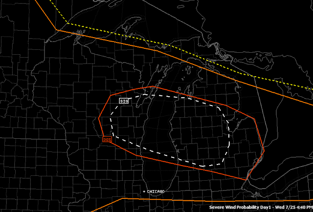
Just a quick update on the severe weather situation. The Storm Prediction Center has refined their targets again for the rest of the forecast window. Look at this image with the updated risk areas:
 |
| The white SIG indicates the best chance for damaging weather, such as wind, hail or tornadoes. At this point it looks like straight-line winds will be the problem. |
Clinton, Shiawassee, Eaton, Ingham - you all have the best shot at storms that will produce high winds tonight. As I indicated this morning it looked like the severe weather would be more of a north zone problem, and this seems to bear that out.
We'll keep an eye on it for you and let you know if things start popping!
No comments:
Post a Comment