Saturday, May 19, 2012

Short & Sweet For A Splendid Saturday!

Good Morning!

No audio forecast today, and just the six-day forecast will be posted.  If time permits, we'll supplement that with some more detailed discussion.

SEVERE WEATHER:  Today, the Storm Prediction Center calls for a general thunderstorm risk across the west half of the Upper Peninsula.  Tomorrow, a general storm risk across West Michigan, perhaps getting into the west counties of the blog, such as Branch, Calhoun, and Eaton.  No formal increased severe risk defined now, but I would not be surprised to see maybe a couple of isolated severe storms with the heating we expect tomorrow.


Here's the forecast for Jackson County:


Today, sunny and warm, high 84.  Winds S 7-14 MPH.


Tonight, starry and nice, low 55, winds SSE 4-9 MPH.


Sunday, sunny and warm during the day, a chance of a widely scattered shower or an embedded thunderstorm late in the day, high 86.


Sunday night, some clouds later during the nighttime hours, a chance of scattered showers and thunderstorms, low 59, winds SW 5-10 MPH.


Monday, mainly cloudy skies, with periods of scattered showers or thunderstorms, high of 78.


Tuesday, a mix of clouds and sunshine after slow clearing in the afternoon with showers departing, seasonable, high 73.


Wednesday, mostly sunny with a few passing clouds, high of 76.


Thursday, bright blue skies and warm, high 83.


That's a look at your forecast for the next six days.  I do hope you enjoy this beautiful weekend.  As I stated above, if time permits, we'll update the blog with more detail and discussion around the next six days.  Blessings!

Friday, May 18, 2012

Fantastic Friday!!!

Good Morning!


Sun, breeze, warmth...rewind and enjoy again.  That's our weather pattern for the next few days here in South Central Michigan, with a brief break in the pattern Monday.  We'll see temperatures vary themselves a bit and a chance at some rain as the weekend winds down and the new work week starts, but outside of that, there's just not much going on!  One deeper dive coming up!


TEMPERATURES:  We'll see daytime highs climb into the 70's today, with tomorrow and Sunday the warmest days of the next several, with the thermometers parking in middle 80's territory.  I wouldn't be shocked to see some areas poking around the 90 mark either.  After that, we moderate a bit and see readings move around in the 70's for awhile.  A light jacket isn't a bad thing to keep handy for the early morning, but you'll definitely not need it again until well after dark, if at all under this setup.


RAIN:  Not a whole lot of that on tap for the next several days.  Computer modeling indicates that we'll have two shots at rain.  The nearest one is Sunday night into Monday, then another chance shows up in the more extended range, with next Saturday looking wet.  Tomorrow and Sunday look great, with a big green light for outdoor activities!  Instead of an umbrella, you'll want sunscreen and a cold beverage.  Here's what the National Weather Service thinks regarding rain for the next 5 days:


That quarter-inch statewide is a bit wetter look than we've had the last couple of days, so let's chat about that briefly.  As we move into Sunday, we get through the day dry.  The debate starts after that, as the models disagree on rain arrival time and coverage.  Depending on which model you ask, rain can start as early as around 5PM Sunday, or as late as midnight, headed into Monday.  We'll hopefully shore that up and narrow the window a bit with subsequent model runs, so you'll know whether you need to take an umbrella along if you dine out or otherwise get away from home for a bit Sunday evening.  I can't ever give you an exact time, or exact rainfall coverage, but if I can get you to a four hour window, that should help you plan.  From what I can see from the perch today, isolated to scattered showers with the mention of a possible buried thunderstorm for Sunday evening into Monday looks right.


SEVERE WEATHER:  That's out of stock currently.  No severe weather in Michigan for the next three days, just the "general" risk of your average thunderstorm in the Upper Peninsula.  In fact, no severe storms are expected anywhere in the continental US today.  The central Plains pick up a "slight" risk area on day two.  Here's the maps from the Storm Prediction Center, valid as always, at 8AM that day.


 Day 1
Day 2


The Grand Rapids NEXRAD radar is quiet as can be, and just a bit of mid-level scattered cloud cover off to the northeast of us on the visible satellite image...


Here's your local forecast for Jackson County:


Today, sunny, splendid, warmer,  high 75, winds SE 6-11 MPH.


Tonight, clear, comfortable, lows near 50, winds S 3-7 MPH.


Saturday, warm, wonderful, plenty of sun...high 84, winds S 5-10 MPH.


Saturday night, starry skies and mild, low of 56, winds SSE 4-9 MPH.


Sunday, sunny during the day, clouds increase later, warmer, a chance of an isolated to scattered shower or an embedded thunderstorm late in the day, high 86.


Monday, cloudy skies, periods of scattered showers or thunderstorms, high of 76.


Tuesday, cloudy skies, showers continue, then clearing slowly in the afternoon as showers depart and take the clouds with them, seasonable, high 73.


Wednesday, a mix of clouds and sunshine with a chance at an isolated shower, high of 74.


There's a look at your Friday forecast and six-day outlook, I do hope you have a wonderful day!
Blessings.

Thursday, May 17, 2012

A Sunshine Spectacular!!!

Good Morning!


REALLY nice weather in place now over South Central Michigan, and it's only going to get better!  A relaxing late spring/early summer pattern is in place.  Temperatures climb with copious sunshine over the next few days and a great weekend looks to be in the cards...One deeper dive on the way!


TEMPERATURES: We get to around 70 for a daytime high today, then into the mid 80's by the end of the weekend!  The GFS and NAM computer models both like 85 for the high on Saturday!  A big ol' ridge containing high pressure and a warm air dome builds in and sits on us for the next few days, so any weather maker lows have to run up well into Canada to get around it.  Lots of clear skies and warm southwesterly breezes on the way, with 73 being the lowest daytime high temperature suggested for the next week!


RAIN:  Perhaps a touch, but not too much.  A very dry look the next several days.  The National Weather Service suggests that we'll pick up a quarter inch of rain at the most in this area between now and 8AM Tuesday...


That idea doesn't look far-fetched to me, owing to the ridge building in.  Our best shot at rain looks to be late Sunday night into Monday, based on the computer modeling.  Looking at it from today's perch, a mention of scattered showers and perhaps a buried thunderstorm sounds right for Monday.  But until then, dry as can be.  Weekend plans have a big green light with no need for rain gear!


SEVERE WEATHER:  Not in this neck of the woods.  The Storm Prediction Center has just the "general" risk of Plain Jane thunderstorms for the western Upper Peninsula.  After that, nothing for the next three days. Here's the Day 1 map from SPC showing that there actually is no severe threat anywhere in the continental US today...


Calm and quiet - I'm sure Joplin, MO and Alabama appreciate this type of pattern, and the quiet tornado season they have had.  It looks like the spring severe weather season is about in the books, with not much here in south central Michigan, outside of the Dexter tornado back in March when we had that unseasonable summer weather pattern.


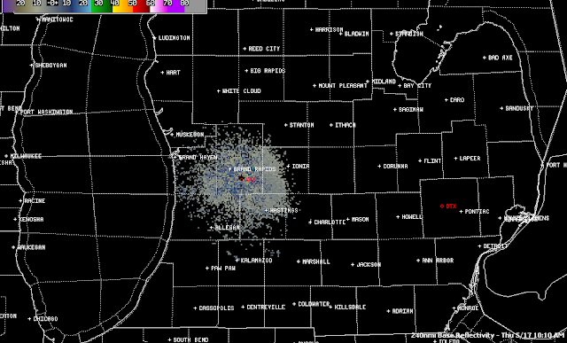
Here's the NEXRAD radar image from Grand Rapids, nothing out there but ground clutter... 


The visible satellite image is blank for lower Michigan as well, except a few clouds as part of that little upper impulse up there that could bug the atmosphere enough to kick off some widely scattered showers or perhaps a lonely thunderstorm later today.


Here's the local forecast for Jackson and surrounding communities including Vandercook Lake and Leoni Township:


Today, sunny, splendid, mild, high of 70, winds E 5-10 MPH.


Tonight, starry skies, not as cool as last night, lows drop to 43 with SE winds 3-8 MPH.


Friday, fantastic!  Sunny, warmer, pleasant, high 75, winds SSE 8-14 MPH.


Friday night, clear, comfortable, lows near 50, winds S 3-7 MPH.


Saturday, clear, warm, wonderful...high 85, winds S 5-10 MPH.


Sunday, sunny, clouds increase later in the day, not as warm, perhaps the chance of an isolated or widely scattered shower late in the day, high 77.


Monday, cloudy skies, periods of scattered showers or possibly an isolated thunderstorm, high of 74.


Tuesday, showers depart along with the clouds, sunshine returns by late in the day with seasonable temperatures, high 73.


That's a look at your forecast for the next 6 days, I do hope your Thursday is a great one!  Blessings.

Wednesday, May 16, 2012

Clouds Rollin' Out...Sun Rollin' In...

Good Morning!


It sure looks like a winner for the next few days here in South Central Michigan now that the system that brought showers and a couple of embedded storms to the area has moved on out.  How does lots of sun and 80's sound to you for the weekend?  I thought you might enjoy that. (smile) Time for a deeper dive into what's going on.


TEMPERATURES:  Temperatures dropped around 10 degrees in most areas as the upper trough pushed through yesterday and last night.  High pressure builds in and keeps us looking great for the next few days, with summer-like temperatures on the way!  We see temperatures in the upper 60's today and tomorrow, then highs reaching into the mid 80's in time for the weekend.  The pattern that we have had this spring continues, with a roughly 15 degree swing between the daytime high and nighttime low. The forecast models are suggesting highs of 84 Saturday and 82 on Sunday.


RAIN:  There were a few severe storms well off to the north and west of us.  By the time the trough and associated front made it into south central Michigan, nighttime had been underway for awhile, so there wasn't any surface heating to destabilize the atmosphere and really feed those storms.  Couple that with low dew points, indicating not a lot of moist air for the storms to ingest, and we got primarily rain showers in this area.  Now that we are on the backside of the system, we shouldn't see any rain for the next several days, just a lot of clear skies.  In fact, here's the map from the National Weather Service for the next five days that shows we are expected to remain BONE DRY...


SEVERE WEATHER:  The Storm Prediction Center isn't expecting anything for us in Michigan for the next three days.  The closest that Michigan gets to anything severe is a "general" risk for plain vanilla thunderstorms that covers the western half of the Upper Peninsula on day 2 - that's it!  Here's that map:


Grand Rapids NEXRAD radar is showing nothing but the usual ground clutter near the radar itself, and the visible satellite image showing just a few lingering clouds that will continue to move away as the day progresses...


Here's the forecast for Jackson and surrounding communities including Parma and Napoleon:


For today, mainly clear skies, a cloud or two passing through, high of 67, winds N 8-15 MPH.


Tonight, lots of stars, crisp, low of 39, winds NNE 3-8 MPH.


Thursday, bright blue skies, seasonable, high of 70, winds NE 5-10 MPH.


Thursday night, still clear, not quite as chilly, low of 45, winds NNE 5-10 MPH.


Friday, mostly sunny skies with a few passing clouds here and there, warmer with a high of 76.


Saturday, sunny, summer-like, splendid, high 83.


Sunday, mainly sunny, clouds start to roll in during the afternoon, high 81.


Monday, cloudy skies, a chance at a widely scattered shower or two, not quite as warm but still mild, high of 77.


There's a look at your forecast for the next six days, I do hope you have a great Hump Day Wednesday!  Blessings!

Tuesday, May 15, 2012

Sunny and Storms?

Good Morning!

Bright blue skies right now in Jackson, but a potentially interesting weather situation is shaping for this afternoon and into the evening hours.  More on that below.


TEMPERATURES:  After this upper level trough moves through, temperatures roll back to the lower 70's, then warmth builds back in and temperatures climb to above 80.

SEVERE WEATHER:  The Storm Prediction Center has parts of all of the midwest states under a "slight" risk for severe thunderstorms.  IL, IN, IA, WI and Michigan.  Now, looking closely at the bullseye on the map, part of the South Central Michigan Weather Zone is in, and part is out.  Weather doesn't follow map boundaries drawn by forecasters.  Everyone needs to have a good source of weather watch and warning information close at hand today.  And guess what: AN OUTDOOR SIREN DOESN'T COUNT! 


An upper level trough will roll in from Canada later today.  As the sun heats the surface, the air will destabilize, and allow for thunderstorm formation this afternoon and evening.  Some of these are expected to be severe.  It looks like the main threat will be from primarily hail and wind, though a tornado cannot be ruled out.

RAIN:  The National Weather Service says that we should get less than a tenth of an inch over the next five days. That being said, depending on where thunderstorms form, I'm thinking something much closer to a quarter-inch should fill the bill in those areas.  After we get through today, it should be smooth sailing until the weekend.


All quiet at this hour on the visible satellite and the Grand Rapids NEXRAD radar.  Here's the local forecast for Jackson County.


For today, mostly sunny skies, clouds start to increase during the afternoon, a chance of an isolated or widely scattered shower or thunderstorm, any storms that do form could go severe, especially in Calhoun and Branch counties.  High 79, winds SW 8-16 MPH.


Tonight, clear, with some passing clouds, continuing with a chance at a shower or thunderstorm, low near 46 winds turn NW 6-12 MPH.


Wednesday, mostly clear, cooler, high near 71, winds NW 5-10 MPH.


Wednesday night, starry skies, a bit chilly, nighttime lows roll all the way back to 38, winds NNW 5-10 MPH.


Thursday, sunny and pleasant, high 71.


Friday, sunny, warmer, nice, high 78.


Saturday, sunny, nice, high 75.


There's a look at your forecast for the next six days.  I do hope you have a good day!  Blessings.

Monday, May 14, 2012

Spring-Loaded Sunshine...

Good Morning!

It looks like a fine day is shaping up here in South Central Michigan with abundant sunshine and seasonable conditions.  Let's get right into it and see what's going on:

TEMPERATURES:  We'll warm up to late spring temperatures over the next few days.  We make a run at 80 tomorrow, and both the GFS and NAM are suggesting 80 for the weekend. Tomorrow, we could certainly see some spots actually post an 80, especially places like Lansing, Battle Creek, and Ann Arbor.  Temperatures will cool a bit as an upper trough moves through tomorrow into Wednesday, bringing some spotty precipitation with it.  After that we'll see the warmer air start to build back in.

RAIN:  We'll see some isolated to widely scattered showers and perhaps a roaming thunderstorm or two throughout the area Wednesday evening into Thursday, then once we get through that, we'll stay basically dry until well into the weekend.  The National Weather Service thinks that all we see the next 5 days is a quarter-inch tops, for most places here in Michigan.  Here's a look at that map.

SEVERE WEATHER:  Nothing forecast aside for Michigan for the next three days, except for a general storm risk tomorrow.  Speaking of tomorrow, Day 2 is worth having a look at.  Here's the map from the Storm Prediction Center, valid at 8AM Tuesday...

See that "slight" risk right over Wisconsin and far northern Illinois, extending just offshore into Lake Michigan?  We'll need to keep an eye on that and see what, if any, adjustments are made during the next 12-24 hours.  As we get closer to the actual day, SPC refines their forecasting, and the bullseyes can shift a bit.  As it stands now, we have a shot at some garden-variety thunderstorms. Anything we get should be the widely spaced pop-up afternoon storms of the non-severe variety.

Right now, Grand Rapids NEXRAD radar is quiet, and here's the visible satellite image showing a whole lot of nothing.


Bright blue skies all across Michigan right now, and it's time for the local forecast for Jackson County:

For today, sunny, pleasant, high 76, winds westerly 5-10 MPH.

Tonight, mostly starry skies, lows down to 46, winds westerly, calm to 5 MPH.

Tuesday, another bright, sunny day, high 78, some spots could see 80, winds SW 7-15 MPH.

Tuesday night, clear, seasonable, with a low down to 48, winds westerly  5-10 MPH.

Wednesday, mainly clear with a few passing clouds, a chance of an isolated or widely scattered shower later in the day, a touch cooler with a high near 73.

Thursday, mostly sunny, high 70.

Friday, mainly sunny, nice, high 75.

That's a look at your forecast for the next six days.  I do hope your Monday is a good one.  Blessings!

Sunday, May 13, 2012

Happy Mother's Day!!!

Good Morning!


First, Happy Mother's Day to all of you Moms and Moms-to-be!  I hope you get spoiled rotten today!


After being on the road and off the grid yesterday, I am back in the saddle today.  I am working on recruiting a backup forecaster to help out when I am unavailable.  Ben Kouchnerkavich was tied up as well, so that's why you had no forecast for the South Central Michigan Weather Zone yesterday.  


Rewinding a bit, Saturday's weekend forecast from Friday went down in flames miserably, as showers persisted all day and all night, with just a peek of sunshine on occasion here and there during the day, and late night fog.  Ewww.  I am looking at the data to see where I erred.  Let's take a look at the rest of this Mother's Day and beyond...


TEMPERATURES:  We'll see temperatures remain a bit on the cool side as the clouds and rain linger through most of the day today.  After that we will see readings moderate as clear skies move into the area and stay with us for a bit, with a ridge building in with a southwesterly flow pushing readings into the mid 70's and higher.  Here's a look at temperatures around the nation currently:


RAIN:  After we get through today, that should be about it for the next five days.  In fact, the National Weather Service is thinking that we will not get much of anything for the next five days.  Even though the National weather Service is predicting nothing measurable, I still think we get at least an isolated shower through the afternoon hours.  It will be cloudy for awhile longer, and there will be periods of mist and drizzle.  Here is the map showing the 5 day rain outlook:


SEVERE WEATHER:  No severe weather or thunderstorms even for Michigan predicted for the next three days according to the Storm Prediction Center.  We are in a pattern where there actually is not a whole lot regarding severe weather going on anywhere in the US.  The next couple of days have the "slight" risk for severe weather focused on New Mexico and Texas.  On day three, there's some discussion about possible isolated thunderstorms that may produce some hail.  At this point, that is centered over Wisconsin and it is too early to tell how large the risk area will be.


Here's a look at the visible satellite image.  Sunny skies are coming soon!  We just have to get this last little bit of cloudiness out of the way!


Here's the forecast for Jackson County:


For the rest of this Mother's Day...cloudy skies, periods of drizzle or perhaps an isolated shower, high of 61, winds ESE 5-10 MPH.


Tonight, clearing, cool, low of 46, winds light and variable.


Monday, mainly clear skies, perhaps a passing cloud, high of 73, winds N 5-10 MPH.


Monday night, clear and cool with lows down to 45, NW winds 5-10 MPH.


Tuesday, clear and nice with a few passing clouds in the afternoon, high 75, winds W 7-14 MPH.


Wednesday, mainly clear skies with some scattered clouds passing through, high near 76.


Thursday, partly cloudy skies, warm, chance of showers, high near 80.


Friday, periods of clouds and sunshine with a chance of showers and thunderstorms in the afternoon, high near 77.


There's a look at your forecast for the next six days, I do hope you have a wonderful day!  Blessings.