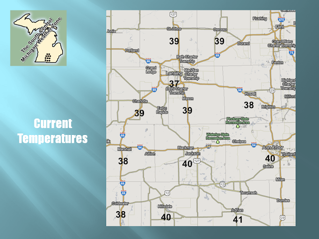
Time to see what fresh weather data brings us in the way of the forecast, and look at a couple of other things with you. First, we are running 10-15 degrees above average at this point, and we'll widen that gap some between now and Saturday. Take a look at this current temperature plot:
Adrian checks in as the warm spot with 41 degrees, a couple of 38's on the board along the I-69 corridor.
SUMMARY: Jackson logged a high of 46 today with a smidgen of rain early this morning, and Charlotte was the warm spot in the blog, with a high of 47. That's over 15 degrees above average and the mercury just keeps moving upward tomorrow, into the weekend. Chilly tonight, mainly clear skies with just a couple of passing clouds allow us to lose our daytime surface heating back into the atmosphere, so we see temperatures drop back to the 20's, with wind chills in single digits or the lower teens, at least until the winds die off some.
Sunny to start tomorrow, then clouds start increasing after lunch as an upper disturbance eventually scoots up here from the Plains and triggers some rain showers with maybe even a thunderstorm. I expect rain to not show until after dinnertime, you should be able to make it home with dry conditions. Thursday night and into Friday, we'll see numerous showers and maybe mention a potential storm, these persist through mid-afternoon Friday.
Daytime Saturday looks OK, then late Saturday into Sunday, here comes the next system, and the mercury plummets.
Here's the forecast for you:


No comments:
Post a Comment